Prieuré Sainte-Thérèse
Prieuré Sainte-Thérèse is a building in Murat, Arrondissement of Saint-Flour, Auvergne-Rhône-Alpes. Prieuré Sainte-Thérèse is situated nearby to Centre hospitalier de Murat, as well as near the farm Ferme de la Grange.| Tap on a place to explore it |
Places of Interest Nearby
Highlights include Gare de Murat and Halle de Murat.
Gare de Murat
Railway station
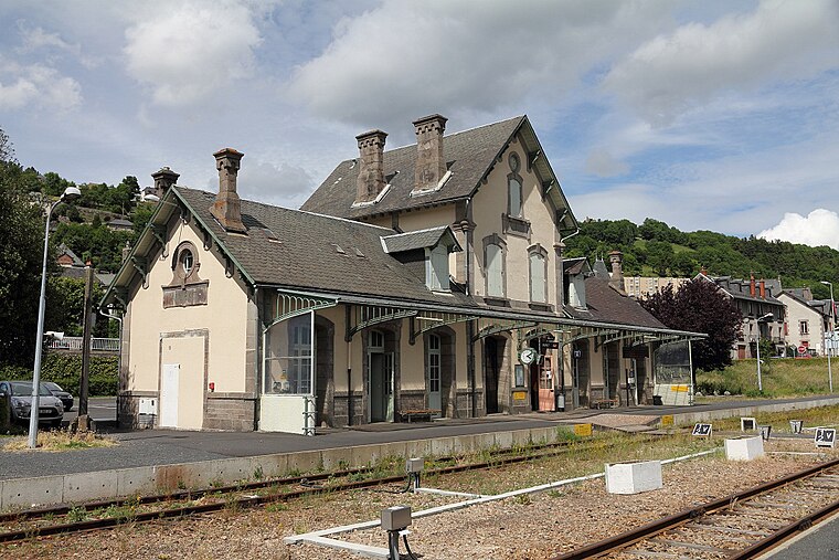
Photo: Lunon92, CC BY-SA 3.0.
Gare de Murat is a railway station, which is situated 270 metres west of Prieuré Sainte-Thérèse.
Halle de Murat
Marketplace

Photo: Olivier1105, CC BY-SA 3.0.
Halle de Murat is a marketplace, which is situated 430 metres northwest of Prieuré Sainte-Thérèse.
Ferme de la Grange
Farm

Photo: Dominique Robert REPERANT, CC BY-SA 3.0.
Ferme de la Grange is a farm, which is situated 120 metres south of Prieuré Sainte-Thérèse.
Places in the Area
Nearby places include Murat and Chastel-sur-Murat.
Murat
Village

Photo: Pline, CC BY-SA 3.0.
Murat is a commune in the Cantal department in the Auvergne region in south-central France. On 1 January 2017, the former commune of Chastel-sur-Murat was merged into Murat. Murat is the administrative seat of this new commune.
Chastel-sur-Murat
Village

Photo: Wikimedia, CC BY-SA 2.0 fr.
Chastel-sur-Murat is a former commune in the Cantal department in south-central France. On 1 January 2017, it was merged into the commune Murat.
Albepierre-Bredons
Village

Photo: Wikimedia, CC BY-SA 3.0.
Albepierre-Bredons is a commune in the département of Cantal and Auvergne region of south-central France. Albepierre-Bredons is situated 5 km southwest of Prieuré Sainte-Thérèse.
Prieuré Sainte-Thérèse
- Type: Building
- Denomination: Catholic
- Location: Murat, Arrondissement of Saint-Flour, Cantal, Auvergne-Rhône-Alpes, France, Europe
- View on OpenStreetMap
Latitude
45.10978° or 45° 6′ 35″ northLongitude
2.87294° or 2° 52′ 23″ eastOpen location code
8FQ44V5F+W5OpenStreetMap ID
way 260326666OpenStreetMap feature
building=conventOpenStreetMap attribute
denomination=catholic
This page is based on OpenStreetMap, Wikidata, and Wikimedia Commons.
We’d love your help improving our open data sources. Thank you for contributing.
Satellite Map
Discover Prieuré Sainte-Thérèse from above in high-definition satellite imagery.
Notable Places Nearby
Highlights include Centre hospitalier de Murat and Maison consulaire.
Nearby Places
Explore places such as Épicerie and Murat.
Auvergne-Rhône-Alpes: Must-Visit Destinations
Delve into Lyon, Grenoble, Clermont-Ferrand, and Saint-Étienne.
Curious Buildings to Discover
Uncover intriguing buildings from every corner of the globe.
About Mapcarta. Data © OpenStreetMap contributors and available under the Open Database License". Text is available under the CC BY-SA 4.0 license, except for photos, directions, and the map. Photo: Velvet, CC BY-SA 3.0.