Prieuré St Michelle
Prieuré St Michelle is an apartment building in Brest, Finistère, Brittany. Prieuré St Michelle is situated nearby to the church Église Saint-Michel, as well as near the sports venue Gymnase de la Marine.| Tap on a place to explore it |
Places of Interest Nearby
Highlights include Église Saint-Michel and Brest station.

Brest station
Railway station
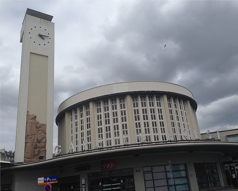
Photo: AirScott, CC BY-SA 4.0.
Brest station is the railway station serving Brest, France. It is the western terminus of the Paris–Brest railway. The new station, built above the town's harbour in 1932 on the site of its 1865 predecessor, includes a tall clock tower and a semi circle passenger hall. Brest station is situated 430 metres south of Prieuré St Michelle.
Cimetière Saint-Martin de Brest
Cemetery

Photo: Philweb, CC BY-SA 3.0.
Cimetière Saint-Martin de Brest is a cemetery, which is situated 320 metres northeast of Prieuré St Michelle.
Places in the Area
Nearby places include Porte Tourville and Jean Bart Gate.


Recouvrance
Suburb

Photo: S. DÉNIEL, CC BY-SA 4.0.
Recouvrance is the section of the city of Brest, France, on the right bank of the River Penfeld. The popular and historically-Breton quarter is in contrast to the largely-Francophone quarter of Brest-même or Brest-proper, on the left bank.
Prieuré St Michelle
- Type: Apartment building
- Categories: building and residential building
- Location: Brest, Arrondissement de Brest, Finistère, Brittany, France, Europe
- View on OpenStreetMap
Latitude
48.39157° or 48° 23′ 30″ northLongitude
-4.47951° or 4° 28′ 46″ westOpen location code
8CWQ9GRC+J5OpenStreetMap ID
way 260491309OpenStreetMap feature
building=apartments
This page is based on OpenStreetMap, Wikidata, and Wikimedia Commons.
We’d love your help improving our open data sources. Thank you for contributing.
Satellite Map
Discover Prieuré St Michelle from above in high-definition satellite imagery.
In Other Languages
“Prieuré St Michelle” goes by many names.
- Breton: “Prioldi St Mikael”
Notable Places Nearby
Highlights include Gymnase de la Marine and Place Sanquer.
Nearby Places
Explore places such as Kanjana thaï bien être and St Michel.
Brittany: Must-Visit Destinations
Delve into Rennes, Finistère, Ille-et-Vilaine, and Morbihan.
Curious Apartment Buildings to Discover
Uncover intriguing apartment buildings from every corner of the globe.
About Mapcarta. Data © OpenStreetMap contributors and available under the Open Database License". Text is available under the CC BY-SA 4.0 license, except for photos, directions, and the map. Photo: Inkey, CC BY-SA 2.5.