ehemaliges Wirtshaus ‘Batzenhütte’
ehemaliges Wirtshaus ‘Batzenhütte’ is a ruins in Saxony, Germany. ehemaliges Wirtshaus ‘Batzenhütte’ is situated nearby to the peak Töpferberg, as well as near the forest Bornwäldchen.| Tap on a place to explore it |
Places of Interest Nearby
Highlights include Sonnenhübel and Schloss Oderwitz.
Sonnenhübel
Peak

Photo: Moritz Wickendorf, CC BY-SA 3.0.
Sonnenhübel is a mountain of Saxony, southeastern Germany.
Schloss Oderwitz
Castle

Photo: Moritz Wickendorf, CC BY-SA 3.0.
Schloss Oderwitz is a castle, which is situated 2 km west of ehemaliges Wirtshaus ‘Batzenhütte’.
Hutberg
Peak

Photo: Moritz Wickendorf, CC BY-SA 3.0.
Hutberg is a mountain of Saxony, southeastern Germany near Oderwitz. Hutberg is situated 3 km south of ehemaliges Wirtshaus ‘Batzenhütte’.
Places in the Area
Nearby places include Oderwitz and Großhennersdorf.
Oderwitz
Village

Photo: Moritz Wickendorf, CC BY-SA 3.0.
Oderwitz is a Saxon municipality in the district Görlitz in Upper Lusatia, Germany. It is located in the southeast of the Free State of Saxony near the border with the Czech Republic. Oderwitz is situated 2½ km southwest of ehemaliges Wirtshaus ‘Batzenhütte’.
Großhennersdorf
Village
 Großhennersdorf is a village and a former municipality in Görlitz district, Saxony, Germany. Since 1 January 2011, it is part of the town Herrnhut. The Bundesstraße 178 connects Großhennersdorf with Löbau and Zittau. Großhennersdorf is situated 3½ km northeast of ehemaliges Wirtshaus ‘Batzenhütte’.
Herrnhut
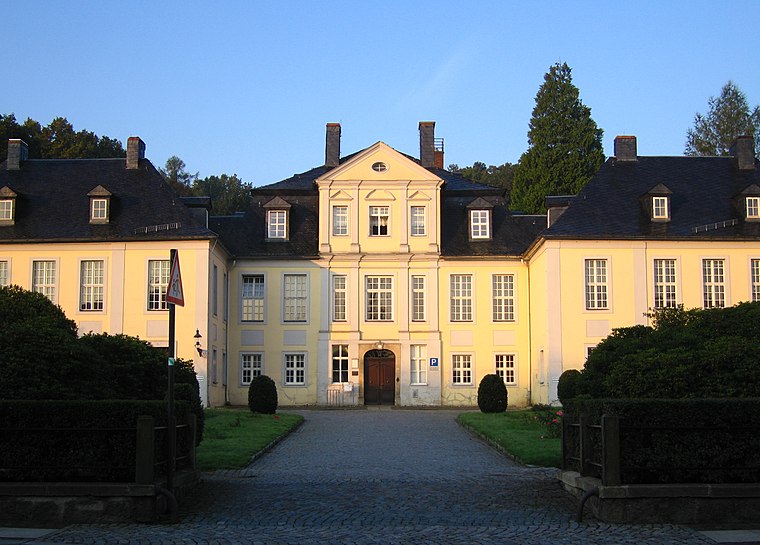
Photo: Rixxo.no.ka.oi, CC BY 3.0.
Herrnhut is a small town in the Upper Lusatia region of Saxony, in Germany. In the 18th century, Herrnhut gave birth to the Moravian spiritual renewal and missions movement under Count Nicolaus Ludwig Von Zinzendorf.
ehemaliges Wirtshaus ‘Batzenhütte’
- Type: Ruins
- Category: historic site
- Location: Saxony, Germany, Central Europe, Europe
- View on OpenStreetMap
Latitude
50.97589° or 50° 58′ 33″ northLongitude
14.74576° or 14° 44′ 45″ eastOpen location code
9F2PXPGW+98OpenStreetMap ID
way 261404764OpenStreetMap feature
historic=ruins
This page is based on OpenStreetMap, Wikidata, and Wikimedia Commons.
We’d love your help improving our open data sources. Thank you for contributing.
Satellite Map
Discover ehemaliges Wirtshaus ‘Batzenhütte’ from above in high-definition satellite imagery.
Notable Places Nearby
Highlights include ehemaliges Wirtshaus ‘Batzenhütte’ and Töpferberg.
Nearby Places
Explore places such as Königsholz and Birkmühle.
Saxony: Must-Visit Destinations
Delve into Dresden, Leipzig, Chemnitz, and Meißen.
Curious Ruins to Discover
Uncover intriguing ruins from every corner of the globe.
About Mapcarta. Data © OpenStreetMap contributors and available under the Open Database License". Text is available under the CC BY-SA 4.0 license, except for photos, directions, and the map. Photo: Taxiarchos228, FAL.