Augustenborg Yachthavns Camping
Augustenborg Yachthavns Camping is a campsite in Sønderborg Municipality, Region of Southern Denmark. Augustenborg Yachthavns Camping is situated nearby to the nature reserve Augustenborg Vildtreservat, as well as near the marina Augustenborg Havn.| Tap on a place to explore it |
Places of Interest Nearby
Highlights include Augustenborg Palace and H.C. Andersen’s linden tree.
Augustenborg Palace
Castle

Photo: PodracerHH, Public domain.
Augustenborg Palace is a Rococo-style palace in the southwestern part of Augustenborg, Als Island, Denmark, overlooking Augustenborg Fjord. The palace owes its name to Duchess Auguste. Augustenborg Palace is situated 460 metres north of Augustenborg Yachthavns Camping.
H.C. Andersen’s linden tree

Photo: Thomas Myllerup, CC BY-SA 4.0.
H.C. Andersen’s linden tree is situated 440 metres northwest of Augustenborg Yachthavns Camping.
Augustiana
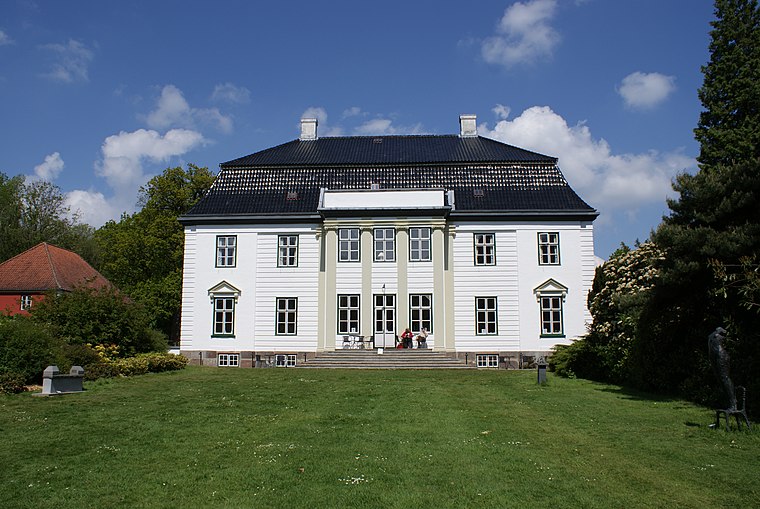
Photo: PodracerHH, Public domain.
Augustiana is situated 680 metres northwest of Augustenborg Yachthavns Camping.
Places in the Area
Nearby places include Augustenborg and Vollerup.
Augustenborg
Village

Photo: Hjart, CC BY-SA 4.0.
Augustenborg is a town on Als Island in Sønderborg Municipality, Region of Southern Denmark in Denmark. The town lies at the head of Als Fjord. To the east is the Little Belt.

Kirke Hørup
Hamlet

Photo: Beethoven9, CC BY-SA 4.0.
Kirke Hørup is a hamlet, which is situated 2½ km southeast of Augustenborg Yachthavns Camping.
Augustenborg Yachthavns Camping
- Type: Campsite
- Categories: tourism and camping
- Location: Sønderborg Municipality, Region of Southern Denmark, Denmark, Nordic countries, Europe
- View on OpenStreetMap
Latitude
54.94068° or 54° 56′ 27″ northLongitude
9.86858° or 9° 52′ 7″ eastOpen location code
9F6FWVR9+7COpenStreetMap ID
way 261657719OpenStreetMap feature
tourism=camp_site
This page is based on OpenStreetMap, Wikidata, and Wikimedia Commons.
We’d love your help improving our open data sources. Thank you for contributing.
Satellite Map
Discover Augustenborg Yachthavns Camping from above in high-definition satellite imagery.
Notable Places Nearby
Highlights include Augustenborg Yachthavn and Augustenborg Vildtreservat.
Nearby Places
Explore places such as MJ Værft Augustenborg I/S and Langdel.
Denmark: Must-Visit Destinations
Delve into Copenhagen, Aarhus, Odense, and Aalborg.
Curious Campsites to Discover
Uncover intriguing campsites from every corner of the globe.
About Mapcarta. Data © OpenStreetMap contributors and available under the Open Database License". Text is available under the CC BY-SA 4.0 license, except for photos, directions, and the map. Photo: Wikimedia, CC BY-SA 3.0.