Sportheim DJK / TSV Rödental e.V.
Sportheim DJK / TSV Rödental e.V. is a building in Rödental, Landkreis Coburg, Bavaria. Sportheim DJK / TSV Rödental e.V. is situated nearby to the fire station Gerätehaus FW Waldsachsen, as well as near the bridge Itztalbrücke.| Tap on a place to explore it |
Places of Interest Nearby
Highlights include Itztalbrücke and Schloss Neuhof.
Itztalbrücke
Bridge
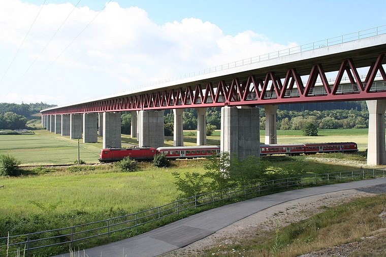
Photo: Störfix, CC BY-SA 3.0.
Itztalbrücke is a bridge, which is situated 660 metres northwest of Sportheim DJK / TSV Rödental e.V..
Schloss Neuhof
Castle

Photo: Störfix, CC BY-SA 3.0.
Schloss Neuhof is a castle, which is situated 1¼ km southeast of Sportheim DJK / TSV Rödental e.V..
St. John (Oeslau)
Church

Photo: Störfix, CC BY-SA 3.0.
St. John (Oeslau) is a church, which is situated 1¼ km northeast of Sportheim DJK / TSV Rödental e.V..
Places in the Area
Nearby places include Waldsachsen and Dörfles bei Coburg.

Dörfles-Esbach
Village

Photo: Störfix, CC BY-SA 3.0.
Dörfles-Esbach is a municipality in the district of Coburg in Bavaria in Germany.
Sportheim DJK / TSV Rödental e.V.
- Type: Building
- Location: Rödental, Landkreis Coburg, Upper Franconia, Franconia, Bavaria, Germany, Central Europe, Europe
- View on OpenStreetMap
Latitude
50.27718° or 50° 16′ 38″ northLongitude
11.02143° or 11° 1′ 17″ eastOpen location code
9F2H72GC+VHOpenStreetMap ID
way 262149058OpenStreetMap feature
building=yes
This page is based on OpenStreetMap, Wikidata, and Wikimedia Commons.
We’d love your help improving our open data sources. Thank you for contributing.
Satellite Map
Discover Sportheim DJK / TSV Rödental e.V. from above in high-definition satellite imagery.
Notable Places Nearby
Highlights include DJK / TSV Rödental e.V. and Gerätehaus FW Waldsachsen.
Nearby Places
Explore places such as Kriegerdenkmal and Waldsachsen Jägersruh (b. Rödental).
Upper Franconia: Must-Visit Destinations
Delve into Bamberg, Bayreuth, Coburg, and Hof.
Curious Buildings to Discover
Uncover intriguing buildings from every corner of the globe.
About Mapcarta. Data © OpenStreetMap contributors and available under the Open Database License". Text is available under the CC BY-SA 4.0 license, except for photos, directions, and the map. Photo: Wikimedia, CC0.