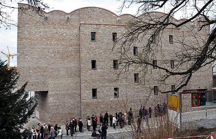
Wehrturm am Hirschgraben
Wehrturm am Hirschgraben is a tower in Ravensburg, Tübingen Region, Baden-Württemberg. Wehrturm am Hirschgraben is situated nearby to the community center Matthäus-Gemeindehaus, as well as near the church Evangelische Stadtkirche Ravensburg.| Tap on a place to explore it |
Places of Interest Nearby
Highlights include Kunstmuseum Ravensburg and Evangelische Stadtkirche Ravensburg.
Kunstmuseum Ravensburg
Museum
 Kunstmuseum Ravensburg is situated 270 metres east of Wehrturm am Hirschgraben.
Evangelische Stadtkirche Ravensburg
Church
 Evangelische Stadtkirche Ravensburg is a church, which is situated 130 metres east of Wehrturm am Hirschgraben.
Kornhaus
Public building
 Kornhaus is a public building, which is situated 210 metres east of Wehrturm am Hirschgraben.
Places in the Area
Nearby places include Berg and Oberzell.
Berg
Village
 Berg is a municipality in the district of Ravensburg in Baden-Württemberg in Germany. Berg is situated 4 km north of Wehrturm am Hirschgraben.
Oberzell
Village
 Oberzell is a village, which is situated 4 km southwest of Wehrturm am Hirschgraben.

Wehrturm am Hirschgraben
- Type: Tower
- Description: wall tower in Ravensburg, Germany
- Categories: fortified tower, building, and historic site
- Location: Ravensburg, Ravensburg, Tübingen Region, Bodensee Region, Baden-Württemberg, Germany, Central Europe, Europe
- View on OpenStreetMap
Latitude
47.7802° or 47° 46′ 49″ northLongitude
9.61132° or 9° 36′ 41″ eastHeight
22 metres (72 feet)Open location code
8FVFQJJ6+3GOpenStreetMap ID
way 262653717OpenStreetMap feature
building=yesOpenStreetMap feature
historic=towerOpenStreetMap feature
man_made=towerWikidata ID
Q34368990
This page is based on OpenStreetMap, Wikidata, and Wikimedia Commons.
We’d love your help improving our open data sources. Thank you for contributing.
Satellite Map
Discover Wehrturm am Hirschgraben from above in high-definition satellite imagery.
In Other Languages
“Wehrturm am Hirschgraben” goes by many names.
- German: “Wehrturm am Hirschgraben”
Places with the Same Name
Discover other places named “Wehrturm am Hirschgraben”.
Notable Places Nearby
Highlights include Hirschgraben and Matthäus-Gemeindehaus.
Nearby Places
Explore places such as Zeller and Seniorentreff Ravensburg e.V..
Bodensee Region: Must-Visit Destinations
Delve into Konstanz, Friedrichshafen, Sigmaringen, and Überlingen.
Curious Towers to Discover
Uncover intriguing towers from every corner of the globe.
About Mapcarta. Data © OpenStreetMap contributors and available under the Open Database License". Text is available under the CC BY-SA 4.0 license, except for photos, directions, and the map. Photo: Wikimedia, CC BY 3.0.