I07
I07 is a building in Visp, Valais. I07 is situated nearby to the playground Kleegärten, as well as near the reservoir K01.| Tap on a place to explore it |
Places of Interest Nearby
Highlights include Visp railway station and Eggerberg railway station.
Visp railway station
Railway station

Photo: Gürbetaler, CC BY-SA 4.0.
Visp railway station is a junction station at Visp, in the canton of Valais, Switzerland. It has a modern station building completed in 2007, and is served by two standard gauge lines and a metre gauge line. Visp railway station is situated 670 metres south of I07.
Eggerberg railway station
Railway station

Photo: NAC, CC BY-SA 4.0.
Eggerberg is a railway station in the Swiss canton of Valais and municipality of Eggerberg. The station is located on the Lötschberg line of the BLS AG, and is adjacent to Eggerberg village. Eggerberg railway station is situated 690 metres north of I07.
Burgerkirche Heilige Drei Könige
Church
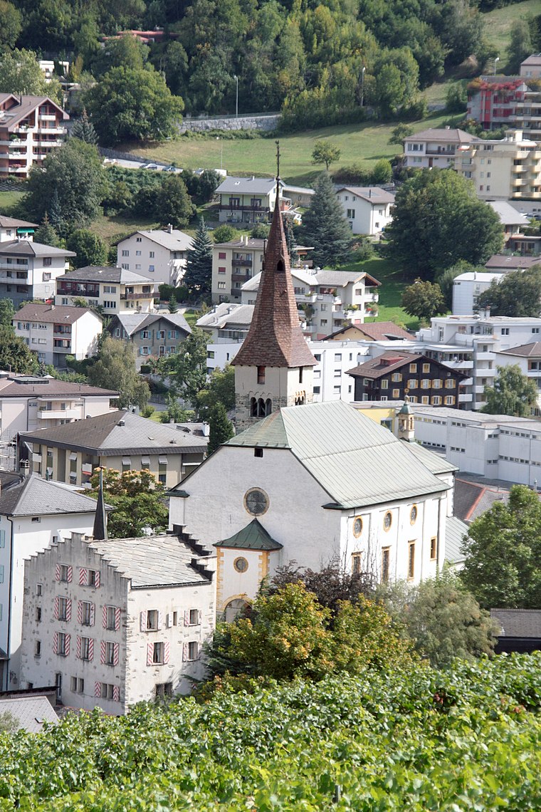
Photo: Amagra lacroix, CC BY-SA 3.0.
Burgerkirche Heilige Drei Könige is a church, which is situated 1 km south of I07.
Places in the Area
Nearby places include Eggerberg and Baltschieder.
Eggerberg
Village

Photo: Berger, CC BY-SA 3.0.
Eggerberg is a village and municipality in the district of Brig in the canton of Valais in Switzerland. Besides the village of Eggerberg, the municipality includes the settlements of Berg, Eggen, Finnen, Mühlackern and Wirmschland.
Baltschieder
Village
Photo: Albins, CC BY-SA 4.0.
Baltschieder is a municipality in the district of Visp in the canton of Valais in Switzerland.
Ausserberg
Village

Photo: Vasile Cotovanu, CC BY 2.0.
Ausserberg is a municipality in the district of Raron in the canton of Valais in Switzerland. Ausserberg is situated 3 km northwest of I07.
I07
- Type: Building
- Location: Visp, Visp District, Valais, Switzerland, Central Europe, Europe
- View on OpenStreetMap
Latitude
46.29982° or 46° 17′ 59″ northLongitude
7.88166° or 7° 52′ 54″ eastOpen location code
8FR97VXJ+WMOpenStreetMap ID
way 263842653OpenStreetMap feature
building=yes
This page is based on OpenStreetMap, Wikidata, and Wikimedia Commons.
We’d love your help improving our open data sources. Thank you for contributing.
Satellite Map
Discover I07 from above in high-definition satellite imagery.
Places with the Same Name
Discover other places named “I07”.
Notable Places Nearby
Highlights include Kleegärten and K01.
Nearby Places
Explore places such as I10 and I11.
Valais: Must-Visit Destinations
Delve into Sion, Zermatt, Martigny, and Brig.
Curious Buildings to Discover
Uncover intriguing buildings from every corner of the globe.
About Mapcarta. Data © OpenStreetMap contributors and available under the Open Database License". Text is available under the CC BY-SA 4.0 license, except for photos, directions, and the map. Photo: Fabienp, CC BY-SA 3.0.