Dalängsskolan
Dalängsskolan is a school in Lidköping socken, Västra Götaland County. Dalängsskolan is situated nearby to the fire station Lidköpings brandstation, as well as near the shopping center Framnäs köpcentrum.| Tap on a place to explore it |
Places of Interest Nearby
Highlights include Vänermuseet and Sparbanken Lidköping Arena.
Vänermuseet
Museum

Photo: Dagjoh, CC BY-SA 3.0.
Vänermuseet is a museum, which is situated 1 km east of Dalängsskolan.
Sparbanken Lidköping Arena
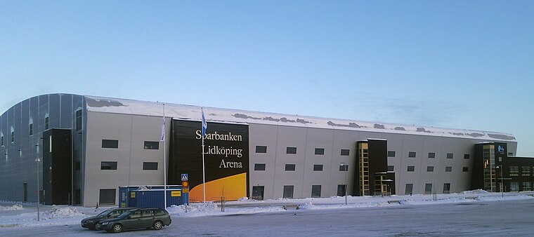 Sparbanken Lidköping Arena is an indoor arena in Lidköping, Sweden. It is the home arena for the bandy team, Villa Lidköping BK. The normal capacity of the arena is 4,500 for bandy games and 12,500 for concerts, and the arena was opened on December 25, 2009. Sparbanken Lidköping Arena is situated 1½ km southeast of Dalängsskolan.
Framnäs City station
Railway stop

Photo: AleWi, CC BY-SA 4.0.
Framnäs City station is a railway stop, which is situated 1 km east of Dalängsskolan.
Places in the Area
Nearby places include Lidköping and Gösslunda.
Lidköping

Photo: Wikimedia, CC BY-SA 3.0.
Lidköping is a city with about 25,000 inhabitants in the province Västergötland in Sweden. It is by the lake Vänern.

Filsbäck
Village
Filsbäck is a locality situated in Lidköping Municipality, Västra Götaland County, Sweden. It had 615 inhabitants in 2010. Filsbäck is situated 7 km east of Dalängsskolan.
Dalängsskolan
- Type: School
- Category: education
- Location: Lidköping socken, Lidköping, Lidköping Municipality, Västra Götaland County, Sweden, Nordic countries, Europe
- View on OpenStreetMap
Latitude
58.50818° or 58° 30′ 29″ northLongitude
13.13155° or 13° 7′ 54″ eastOpen location code
9FCMG45J+7JOpenStreetMap ID
way 265422304OpenStreetMap feature
amenity=school
This page is based on OpenStreetMap, Wikidata, and Wikimedia Commons.
We’d love your help improving our open data sources. Thank you for contributing.
Satellite Map
Discover Dalängsskolan from above in high-definition satellite imagery.
Notable Places Nearby
Highlights include Lidköpings brandstation and Framnäs köpcentrum.
Nearby Places
Explore places such as Korttidshemmet Grodden and Stenportskolan.
Sweden: Must-Visit Destinations
Delve into Stockholm, Uppsala, Gothenburg, and Malmö.
Curious Places to Discover
Uncover intriguing places from every corner of the globe.
About Mapcarta. Data © OpenStreetMap contributors and available under the Open Database License". Text is available under the CC BY-SA 4.0 license, except for photos, directions, and the map. Photo: Wikimedia, Public domain.