P23
P23 is a parking area in Bad Tölz, Upper Bavaria, Bavaria. P23 is situated nearby to Bad Tölz railway station, as well as near the railway station Bahnhof Bad Tölz.| Tap on a place to explore it |
- Type: Parking area
- Parking: surface
- Wheelchair access: yes
Places of Interest Nearby
Highlights include Bad Tölz railway station and Hacker-Pschorr Arena.

Hacker-Pschorr Arena
Stadium
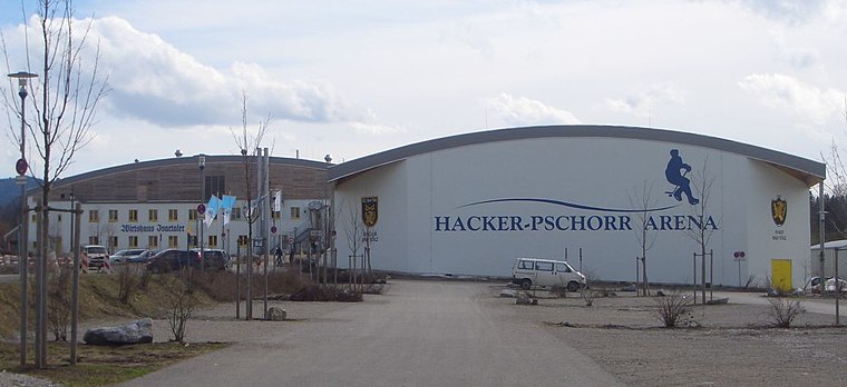
Photo: Daniel Hüneborg, CC BY 2.0.
Hacker-Pschorr Arena is a stadium, which is situated 470 metres southeast of P23.
Mühlfeldkirche
Church

Photo: Rufus46, CC BY-SA 3.0.
Mühlfeldkirche is a church, which is situated 740 metres west of P23.
Places in the Area
Nearby places include Eichmühle and Bad Tölz.

Bad Tölz
Town

Photo: MarkusZi, CC BY-SA 3.0.
Bad Tölz is a town in Bavaria, Germany and the administrative center of the Bad Tölz-Wolfratshausen district.
Kalvarienberg (Bad Tölz)
Locality

Photo: SchiDD, CC BY-SA 3.0 de.
Kalvarienberg (Bad Tölz) is a locality.
P23
- Category: transportation
- Location: Bad Tölz, Bad Tölz-Wolfratshausen, Upper Bavaria, Bavaria, Germany, Central Europe, Europe
- View on OpenStreetMap
Latitude
47.76035° or 47° 45′ 37″ northLongitude
11.57465° or 11° 34′ 29″ eastOpen location code
8FVHQH6F+4VOpenStreetMap ID
way 26698669OpenStreetMap feature
amenity=parkingOpenStreetMap attribute
parking=surfaceOpenStreetMap attribute
wheelchair=yes
This page is based on OpenStreetMap, Wikidata, and Wikimedia Commons.
We’d love your help improving our open data sources. Thank you for contributing.
Satellite Map
Discover P23 from above in high-definition satellite imagery.
Places with the Same Name
Discover other places named “P23”.
Notable Places Nearby
Highlights include Bahnhof Bad Tölz and Bad Tölz, Bahnhof.
Nearby Places
Explore places such as BRB Kundencenter and Bad Tölz, Bahnhof Süd.
Upper Bavaria: Must-Visit Destinations
Delve into Munich, Ingolstadt, Dachau, and Rosenheim.
Curious Parking Areas to Discover
Uncover intriguing parking areas from every corner of the globe.
About Mapcarta. Data © OpenStreetMap contributors and available under the Open Database License". Text is available under the CC BY-SA 4.0 license, except for photos, directions, and the map. Photo: Aconcagua, CC BY-SA 3.0.