Kurt-Rieß-Anlage
Kurt-Rieß-Anlage is a sports venue in Leverkusen, Cologne District, North Rhine-Westphalia. Kurt-Rieß-Anlage is situated nearby to the athletics track Kurt-Rieß-Laufbahn, as well as near the sports venue Herbert-Grünewald-Halle.| Tap on a place to explore it |
Places of Interest Nearby
Highlights include Doktorsburg and Forum Leverkusen.
Doktorsburg
Community center

Photo: Dave24, CC BY-SA 2.5.
Doktorsburg is a community center, which is situated 330 metres south of Kurt-Rieß-Anlage.
Forum Leverkusen
Theater building

Photo: Wikimedia, CC BY-SA 3.0.
Forum Leverkusen is a theater building, which is situated 340 metres southwest of Kurt-Rieß-Anlage.
Ulrich-Haberland-Stadion
Stadium
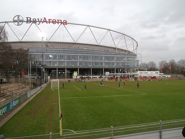
Photo: Hobby-Fotograf2013, CC BY-SA 3.0.
Ulrich-Haberland-Stadion is a stadium, which is situated 480 metres east of Kurt-Rieß-Anlage.
Places in the Area
Nearby places include Opladen and Köln-Rheinkassel.
Opladen
Suburb
Opladen, now a district of Leverkusen, used to be the capital of the Rhein-Wupper-Kreis until 1975. Opladen station is located 15 kilometres northeast from Cologne on the railway to Wuppertal. Opladen is situated 3½ km north of Kurt-Rieß-Anlage.
Köln-Rheinkassel
Village

Photo: Elya, CC BY-SA 3.0.
Köln-Rheinkassel is a village, which is situated 4 km west of Kurt-Rieß-Anlage.
Mehlbruch
Neighborhood

Photo: Ritter-pitter, CC BY-SA 3.0.
Mehlbruch is a neighborhood, which is situated 5 km northwest of Kurt-Rieß-Anlage.
Kurt-Rieß-Anlage
- Type: Sports venue
- Categories: recreation area and sports location
- Location: Leverkusen, Cologne District, Cologne Lowland, North Rhine-Westphalia, Germany, Central Europe, Europe
- View on OpenStreetMap
Latitude
51.03677° or 51° 2′ 12″ northLongitude
6.99345° or 6° 59′ 36″ eastOpen location code
9F382XPV+P9OpenStreetMap ID
way 267626118OpenStreetMap feature
leisure=sports_centre
This page is based on OpenStreetMap, Wikidata, and Wikimedia Commons.
We’d love your help improving our open data sources. Thank you for contributing.
Satellite Map
Discover Kurt-Rieß-Anlage from above in high-definition satellite imagery.
Notable Places Nearby
Highlights include Kurt-Rieß-Laufbahn and Herbert-Grünewald-Halle.
Nearby Places
Explore places such as Parkplatz unter der Stelzenbrücke and Sportinternat Leverkusen.
Cologne Lowland: Must-Visit Destinations
Delve into Cologne, Bonn, Siegburg, and Bad Honnef.
Curious Sports Venues to Discover
Uncover intriguing sports venues from every corner of the globe.
About Mapcarta. Data © OpenStreetMap contributors and available under the Open Database License". Text is available under the CC BY-SA 4.0 license, except for photos, directions, and the map. Photo: A.Savin, CC BY-SA 3.0.