Schützenverein Hubertus Parkplatz
Schützenverein Hubertus Parkplatz is a parking area in Ottersweier, Rastatt, Baden-Württemberg. Access is restricted and requires permission. Schützenverein Hubertus Parkplatz is situated nearby to Schützenhaus Ottersweier, as well as near the pitch Kleinkaliber-Stand (50 Meter).| Tap on a place to explore it |
- Access is restricted and requires permission.
- Type: Parking area
- Parking: surface
Places of Interest Nearby
Highlights include St. Antonius and Maria Linden.
St. Antonius
Church

Photo: Gerd Eichmann, CC BY-SA 4.0.
St. Antonius is a church, which is situated 520 metres north of Schützenverein Hubertus Parkplatz.
Maria Linden
Church
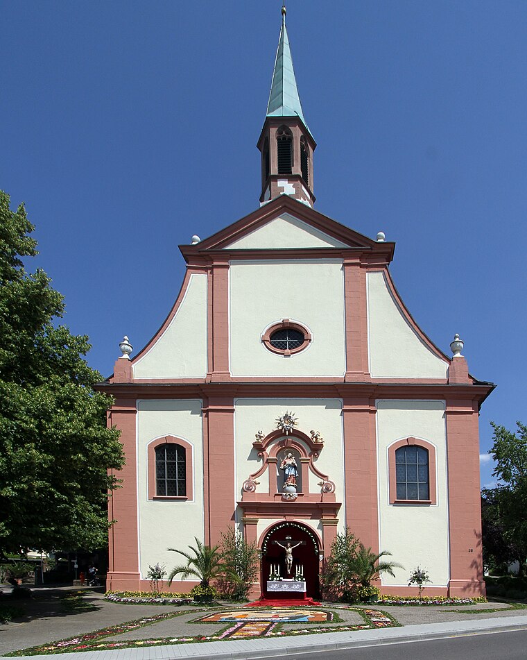
Photo: Gerd Eichmann, CC BY-SA 4.0.
Maria Linden is a church, which is situated 1 km southeast of Schützenverein Hubertus Parkplatz.
St. Johannes
Church

Photo: Gerd Eichmann, CC BY-SA 4.0.
St. Johannes is a church, which is situated 1 km south of Schützenverein Hubertus Parkplatz.
Places in the Area
Nearby places include Bühl and Lauf.
Bühl
Town

Photo: Frank C. Müller, CC BY-SA 3.0.
Baden-Baden is a spa town built on thermal springs at the edge of the Black Forest in Baden Württemberg, south west Germany. It is one of 11 "Great Spa Towns of Europe", a transcontinental UNESCO world heritage site. Bühl is situated 2½ km northeast of Schützenverein Hubertus Parkplatz.
Lauf
Village

Photo: Gerd Eichmann, CC BY-SA 4.0.
Lauf is a municipality in the district of Ortenau in Western Baden-Württemberg, Germany. Lauf is a locality positioned at the western periphery of the Black Forest, also known as Schwarzwald, within the valley of Laufbachtal. Lauf is situated 3½ km south of Schützenverein Hubertus Parkplatz.
Sasbach
Village

Photo: Metallissimus, CC BY-SA 3.0.
Sasbach is a municipality in the district of Ortenau in Western Baden-Württemberg, Germany. Sasbach is situated 4½ km south of Schützenverein Hubertus Parkplatz.
Schützenverein Hubertus Parkplatz
- Category: transportation
- Location: Ottersweier, Rastatt, Karlsruhe Region, Baden-Württemberg, Germany, Central Europe, Europe
- View on OpenStreetMap
Latitude
48.67708° or 48° 40′ 38″ northLongitude
8.11142° or 8° 6′ 41″ eastOpen location code
8FWCM4G6+RHOpenStreetMap ID
way 26824936OpenStreetMap feature
amenity=parkingOpenStreetMap attribute
parking=surface
This page is based on OpenStreetMap, Wikidata, and Wikimedia Commons.
We’d love your help improving our open data sources. Thank you for contributing.
Satellite Map
Discover Schützenverein Hubertus Parkplatz from above in high-definition satellite imagery.
Notable Places Nearby
Highlights include Schützenhaus Ottersweier and Kleinkaliber-Stand (50 Meter).
Nearby Places
Explore places such as Peka Pflasterbau Erdbau Kabelbaum GmbH and Walter GmbH Stahl- und Maschinenbau.
Baden-Württemberg: Must-Visit Destinations
Delve into Stuttgart, Heidelberg, Karlsruhe, and Mannheim.
Curious Parking Areas to Discover
Uncover intriguing parking areas from every corner of the globe.
About Mapcarta. Data © OpenStreetMap contributors and available under the Open Database License". Text is available under the CC BY-SA 4.0 license, except for photos, directions, and the map. Photo: Traveler100, CC BY-SA 3.0.