Pontanus-Carrée
Pontanus-Carrée is a social service facility in Paderborn, Detmold, North Rhine-Westphalia. Pontanus-Carrée is situated nearby to the community center Nachbarschaftstreff Abbestraße, as well as near the government office Stadt- und Kreisarchiv Paderborn.| Tap on a place to explore it |
Places of Interest Nearby
Highlights include Paderborn Hauptbahnhof and Herz-Jesu-Kirche.
Paderborn Hauptbahnhof
Railway station

Photo: Tohma, CC BY-SA 4.0.
Paderborn Hauptbahnhof is the main passenger station in the city of Paderborn in the German state of North Rhine-Westphalia. It is located on the Hamm–Warburg line, part of the Mid-Germany Connection from Cologne or Düsseldorf to Thuringia and Saxony. Paderborn Hauptbahnhof is situated 1 km east of Pontanus-Carrée.
Herz-Jesu-Kirche
Church

Photo: Zefram, CC BY 2.0 de.
Herz-Jesu-Kirche is a church, which is situated 1¼ km east of Pontanus-Carrée.
Historisches Rathaus Paderborn
Town hall
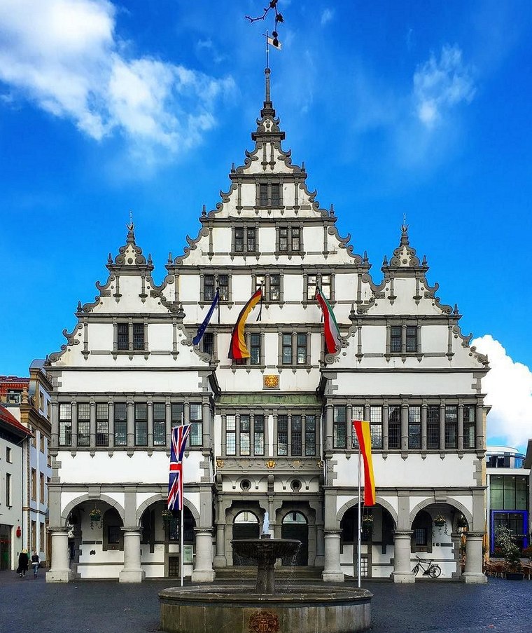
Photo: Sunnysteffen, CC BY-SA 4.0.
Historisches Rathaus Paderborn is a town hall, which is situated 2 km east of Pontanus-Carrée.
Places in the Area
Nearby places include Borchen and Sennelager.
Borchen
Village

Photo: Unixbook, CC BY-SA 3.0.
Borchen is a municipality in the district of Paderborn, in North Rhine-Westphalia, Germany. Borchen is situated 6 km south of Pontanus-Carrée.
Sennelager
Village
Sennelager is a village in Germany that forms part of the City of Paderborn. It is notable for its association with the military since the 19th century. Sennelager is situated 7 km north of Pontanus-Carrée.
Benhausen
Village

Photo: Philipp Sx86, CC BY-SA 3.0.
Benhausen is a village, which is situated 8 km northeast of Pontanus-Carrée.
Pontanus-Carrée
Latitude
51.71346° or 51° 42′ 49″ northLongitude
8.72588° or 8° 43′ 33″ eastOpen location code
9F3CPP7G+99OpenStreetMap ID
way 269072741OpenStreetMap feature
amenity=social_facility
This page is based on OpenStreetMap, Wikidata, and Wikimedia Commons.
We’d love your help improving our open data sources. Thank you for contributing.
Satellite Map
Discover Pontanus-Carrée from above in high-definition satellite imagery.
Notable Places Nearby
Highlights include Nachbarschaftstreff Abbestraße and Stadt- und Kreisarchiv Paderborn.
Nearby Places
Explore places such as Quartiersbüro and Technisches Rathaus.
Teutoburg Forest: Must-Visit Destinations
Delve into Bielefeld, Detmold, Gütersloh, and Minden.
Curious Social Service Facilities to Discover
Uncover intriguing social service facilities from every corner of the globe.
About Mapcarta. Data © OpenStreetMap contributors and available under the Open Database License". Text is available under the CC BY-SA 4.0 license, except for photos, directions, and the map. Photo: Wikimedia, CC0.