HM Zrínyi Nonprofit Kft.
HM Zrínyi Nonprofit Kft. is a government office in Budapest, Central Hungary which is located on Szilágyi Erzsébet fasor. HM Zrínyi Nonprofit Kft. is situated nearby to the museum Magyar Katonai Térképészet Szakmatörténeti Múzeuma, as well as near the government office Infokommunikációs Államtitkárság.| Tap on a place to explore it |
- Type: Government office
- Address: Szilágyi Erzsébet fasor 9, Budapest, 1024
- Roof shape: gabled
Places of Interest Nearby
Highlights include Budapest Cog-wheel Railway and Városmajor Church.
Budapest Cog-wheel Railway
Railway station

Photo: Wo st 01, CC BY-SA 3.0 de.
The Budapest Cog-wheel Railway is a rack railway in the Buda part of the Hungarian capital city of Budapest. It connects a lower terminus at Városmajor, two tram stops away from the Széll Kálmán tér transport interchange, with an upper terminus at Széchenyihegy. Budapest Cog-wheel Railway is situated 520 metres west of HM Zrínyi Nonprofit Kft..
Városmajor Church
Church
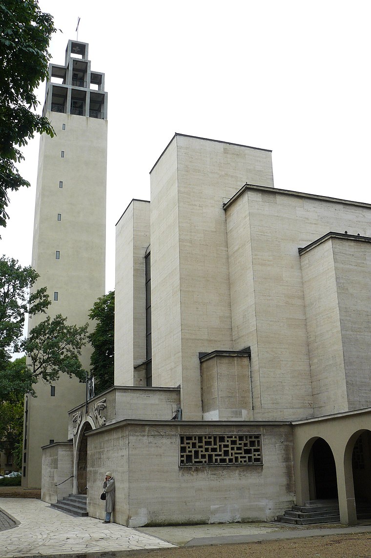
Photo: MOs810, CC BY-SA 4.0.
Városmajor Church is situated 320 metres south of HM Zrínyi Nonprofit Kft..
Városmajor Chapel
Community center

Photo: Rimanóczyjeno, CC BY-SA 3.0.
Városmajor Chapel is a community center, which is situated 340 metres southeast of HM Zrínyi Nonprofit Kft..
Places in the Area
Nearby places include Városmajor and Víziváros.

Víziváros

Photo: Tsy1980, CC BY-SA 4.0.
Víziváros is in Budapest. This article describes the outer part of the 1st district, which includes parts of Gellérthegy, Krisztinaváros, Tabán and Víziváros.
Rózsadomb
Suburb

Photo: VinceB, CC BY-SA 3.0.
The area known as Rózsadomb is a wealthy area in the 2nd district of Budapest, the capital of Hungary. It is a member of the Buda Hills.
HM Zrínyi Nonprofit Kft.
- Categories: building, office, and government building
- Location: Budapest, Central Hungary, Hungary, Central Europe, Europe
- View on OpenStreetMap
Latitude
47.50877° or 47° 30′ 32″ northLongitude
19.01957° or 19° 1′ 10″ eastLevels
3Open location code
8FVXG259+GROpenStreetMap ID
way 271007257OpenStreetMap feature
building=yesOpenStreetMap feature
office=governmentOpenStreetMap attribute
roof-shape=gabled
This page is based on OpenStreetMap, Wikidata, and Wikimedia Commons.
We’d love your help improving our open data sources. Thank you for contributing.
Satellite Map
Discover HM Zrínyi Nonprofit Kft. from above in high-definition satellite imagery.
Places with the Same Name
Discover other places named “HM Zrínyi Nonprofit Kft.”.
Notable Places Nearby
Highlights include Magyar Katonai Térképészet Szakmatörténeti Múzeuma and Infokommunikációs Államtitkárság.
Nearby Places
Explore places such as Hotel Belvedere Budapest and Coworking.
Budapest: Must-Visit Destinations
Delve into Belváros, Víziváros, Óbuda, and East Pest.
Curious Government Offices to Discover
Uncover intriguing government offices from every corner of the globe.
About Mapcarta. Data © OpenStreetMap contributors and available under the Open Database License". Text is available under the CC BY-SA 4.0 license, except for photos, directions, and the map. Photo: Chmehl, CC BY 3.0.