ElterSports
ElterSports is a sports venue in Grünwald, Munich, Bavaria. ElterSports is situated nearby to the playground COCO LOCO, as well as near the town Grünwald.| Tap on a place to explore it |
Places of Interest Nearby
Highlights include Grünwald Castle and Wasserkraftwerk Pullach.
Grünwald Castle
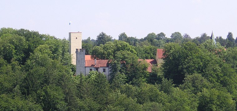
Photo: Wikimedia, CC BY-SA 3.0.
Grünwald Castle is a medieval hill castle in Grünwald, Bavaria. Grünwald Castle is situated 1 km southwest of ElterSports.
Wasserkraftwerk Pullach
Power station
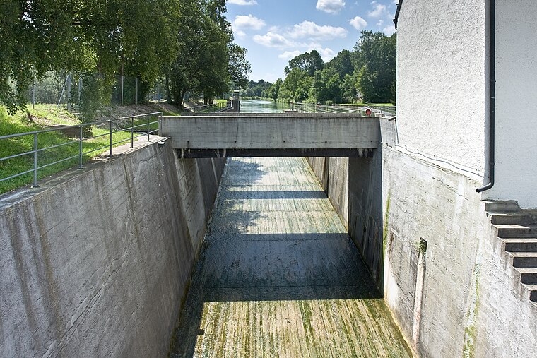
Photo: Richard Bartz, CC BY-SA 2.5.
Wasserkraftwerk Pullach is a power station, which is situated 790 metres northwest of ElterSports.
Grünwald Castle Museum
Museum

Photo: Rufus46, Public domain.
Grünwald Castle Museum is situated 1 km southwest of ElterSports.
Places in the Area
Nearby places include Grünwald and Pullach.
Grünwald
Town
Photo: Wikimedia, CC BY-SA 3.0.
Grünwald is a municipality in the district of Munich, in the state of Bavaria, Germany. It is located on the right bank of the Isar, 12 km southwest of Munich.
Pullach
Village

Photo: Wikimedia, CC BY-SA 3.0.
Pullach, officially Pullach i. Isartal, is a municipality in the district of Munich in Bavaria in Germany. It lies on the Isar Valley Railway and is served by the S 7 line of the Munich S-Bahn, at the Großhesselohe Isartalbahnhof, Pullach and Höllriegelskreuth railway stations.

ElterSports
- Type: Sports venue
- Roof shape: gabled
- Categories: tennis, building, recreation area, and sports location
- Location: Grünwald, Munich, Upper Bavaria, Bavaria, Germany, Central Europe, Europe
- View on OpenStreetMap
Latitude
48.04875° or 48° 2′ 56″ northLongitude
11.5315° or 11° 31′ 53″ eastOpen location code
8FWH2GXJ+FHOpenStreetMap ID
way 27364197OpenStreetMap feature
building=yesOpenStreetMap feature
leisure=sports_centreOpenStreetMap feature
sport=tennisOpenStreetMap attribute
roof-shape=gabled
This page is based on OpenStreetMap, Wikidata, and Wikimedia Commons.
We’d love your help improving our open data sources. Thank you for contributing.
Satellite Map
Discover ElterSports from above in high-definition satellite imagery.
Notable Places Nearby
Highlights include COCO LOCO and Liegewiese.
Nearby Places
Explore places such as ElterSports and Fix&Foxi.
Upper Bavaria: Must-Visit Destinations
Delve into Munich, Ingolstadt, Rosenheim, and Dachau.
Curious Sports Venues to Discover
Uncover intriguing sports venues from every corner of the globe.
About Mapcarta. Data © OpenStreetMap contributors and available under the Open Database License". Text is available under the CC BY-SA 4.0 license, except for photos, directions, and the map. Photo: Aconcagua, CC BY-SA 3.0.