Palliser School parking
Palliser School parking is a parking area in Calgary, Calgary Region, Alberta. Access is restricted and requires permission. Palliser School parking is situated nearby to the sports venue Sir Winston Churchill Aquatic & Recreation Centre, as well as near Brentwood Sport Complex.| Tap on a place to explore it |
Places of Interest Nearby
Highlights include Sir Winston Churchill High School and Brentwood station.
Sir Winston Churchill High School
School

Photo: Thivierr, Public domain.
Sir Winston Churchill High School is a senior high school in Calgary, Alberta, Canada. It derives its name from Sir Winston Churchill, two-term prime minister of the United Kingdom. Sir Winston Churchill High School is situated 370 metres northwest of Palliser School parking.
Brentwood station
Railway station

Photo: Thivierr, CC BY-SA 3.0.
Brentwood Station is a Calgary C-Train light rail station on the Red Line, between University Station southbound and Dalhousie Station northbound. The station is located in the middle of Crowchild Trail, wedged between the communities of Brentwood to the north, and Varsity to the south. Brentwood station is situated 1¼ km south of Palliser School parking.
Dalhousie station
Railway station
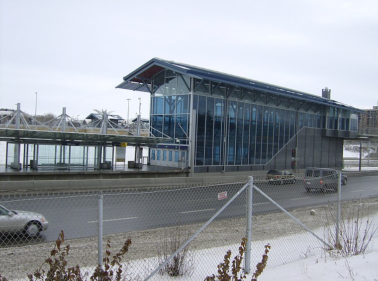
Photo: Thivierr, CC BY-SA 3.0.
Dalhousie station is a CTrain light rail station in Dalhousie, Calgary, Alberta, Canada. It opened on December 15, 2003, as part of a 2.8 km extension of the Northwest line, and was the terminal station of the NW line until June 14, 2009. Dalhousie station is situated 2 km northwest of Palliser School parking.
Places in the Area
Nearby places include Brentwood and Varsity.
Brentwood
Suburb
Brentwood is a neighbourhood in the northwest quadrant of Calgary, Alberta. The neighbourhood is bordered by John Laurie Boulevard to the north, Crowchild Trail to the south, Shaganappi Trail to the west, and Brisebois Drive & Charleswood Drive on the east.
Varsity
Suburb
Varsity is an established neighbourhood in the Northwest quadrant of Calgary, Alberta. It was developed in the 1960s and early 1970s on a plateau to the north of the Bow River valley, and is primarily composed of Single-detached dwellings on wide lots.
Dalhousie
Suburb
Dalhousie is a neighbourhood in the northwest area of Calgary. It is bounded to the north by John Laurie Boulevard, to the east by Shaganappi Trail, to the south by Crowchild Trail and to the west by Sarcee Trail.
Palliser School parking
- Access is restricted and requires permission.
- Type: Parking area
- Category: transportation
- Location: Calgary, Calgary Region, Alberta, Prairies, Canada, North America
- View on OpenStreetMap
Latitude
51.09676° or 51° 5′ 48″ northLongitude
-114.13696° or 114° 8′ 13″ westOpen location code
95373VW7+P6OpenStreetMap ID
way 275784893OpenStreetMap feature
amenity=parking
This page is based on OpenStreetMap, Wikidata, and Wikimedia Commons.
We’d love your help improving our open data sources. Thank you for contributing.
Satellite Map
Discover Palliser School parking from above in high-definition satellite imagery.
Notable Places Nearby
Highlights include Sir Winston Churchill Aquatic & Recreation Centre and Brentwood Sport Complex.
Nearby Places
Explore places such as Captain John Palliser School and Churchill Aquatic Centre, Nose Hill Library & Brentwood Sportplex parking.
Calgary: Must-Visit Destinations
Delve into City Centre, Northwest Calgary, Southwest Calgary, and Southeast Calgary.
Curious Parking Areas to Discover
Uncover intriguing parking areas from every corner of the globe.
About Mapcarta. Data © OpenStreetMap contributors and available under the Open Database License". Text is available under the CC BY-SA 4.0 license, except for photos, directions, and the map. Photo: Wikimedia, CC0.