Balsa de la Dehesa de Ibar
Balsa de la Dehesa de Ibar is a pond in Muel Municipality, Saragossa, Aragon. Balsa de la Dehesa de Ibar is situated nearby to the pond Balsa de Mitiicas, as well as near the peak Cabezo la Torre.| Tap on a place to explore it |
Places in the Area
Nearby places include Muel and La Muela.
Muel
Village

Photo: LBM1948, CC BY-SA 4.0.
Muel is a municipality located in the province of Zaragoza, Aragon, Spain. According to the 2004 census, the municipality has a population of 1,142 inhabitants. Muel is situated 8 km southeast of Balsa de la Dehesa de Ibar.
La Muela
Village
 La Muela is a municipality located in the Valdejalón comarca, province of Zaragoza, Aragon, Spain. According to the INE, La Muela had a population of 5,894 in 2020, increased from 5,479 in 2018 and from 4,928 in 2009. La Muela is situated 9 km northeast of Balsa de la Dehesa de Ibar.
Mozota
Village
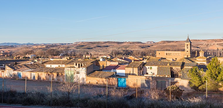
Photo: Wikimedia, CC BY-SA 4.0.
Mozota is a small town and municipality in Zaragoza province 25 km southwest of Zaragoza, Aragon, Spain. Mozota is situated 9 km east of Balsa de la Dehesa de Ibar.
Balsa de la Dehesa de Ibar
- Type: Pond (intermittent)
- Category: body of water
- Location: Muel Municipality, Saragossa, Aragon, Northern Spain, Spain, Iberia, Europe
- View on OpenStreetMap
Latitude
41.51199° or 41° 30′ 43″ northLongitude
-1.16564° or 1° 9′ 56″ westOpen location code
8CHWGR6M+QPOpenStreetMap ID
way 277303428OpenStreetMap feature
natural=waterOpenStreetMap feature
water=pondOpenStreetMap attribute
intermittent=yes
This page is based on OpenStreetMap, Wikidata, and Wikimedia Commons.
We’d love your help improving our open data sources. Thank you for contributing.
Satellite Map
Discover Balsa de la Dehesa de Ibar from above in high-definition satellite imagery.
Notable Places Nearby
Highlights include Balsa de Mitiicas and Muelense.
Nearby Places
Explore places such as Casetas de la Dehesa de Ibar and Muel - AE.
Aragon: Must-Visit Destinations
Delve into Zaragoza, Huesca, Teruel, and Calatayud.
Curious Ponds to Discover
Uncover intriguing ponds from every corner of the globe.
About Mapcarta. Data © OpenStreetMap contributors and available under the Open Database License". Text is available under the CC BY-SA 4.0 license, except for photos, directions, and the map. Photo: Jiuguang Wang, CC BY-SA 3.0 es.