Industriegebiet Charlottenhof
Industriegebiet Charlottenhof is in Beeskow, Oder-Spree, Brandenburg. Industriegebiet Charlottenhof is situated nearby to the cemetery Friedhof, as well as near the railway station Beeskow station.| Tap on a place to explore it |
Places of Interest Nearby
Highlights include Beeskow station and Burg Beeskow.
Beeskow station
Railway station

Photo: Global Fish, CC BY-SA 3.0.
Beeskow station is a railway station in the municipality of Beeskow, located in the Oder-Spree district in Brandenburg, Germany. Beeskow station is situated 780 metres south of Industriegebiet Charlottenhof.
Burg Beeskow
Castle

Photo: A.Savin, CC BY-SA 3.0.
Burg Beeskow is a castle, which is situated 1½ km south of Industriegebiet Charlottenhof.
The oldest house in Beeskow

Photo: MOs810, CC BY-SA 4.0.
The oldest house in Beeskow is situated 1½ km south of Industriegebiet Charlottenhof.
Places in the Area
Nearby places include Beeskow and Bahrensdorf.
Beeskow
Town
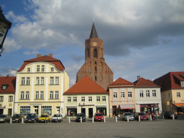
Photo: Gt-man, CC BY-SA 2.0 de.
Beeskow is a town in Brandenburg, in eastern Germany, and capital of the Oder-Spree district. It is situated on the river Spree, 30 km southwest of Frankfurt an der Oder.

Radinkendorf
Village

Photo: Assenmacher, CC BY-SA 4.0.
Radinkendorf is a village, which is situated 3½ km northeast of Industriegebiet Charlottenhof.
Industriegebiet Charlottenhof
- Type: Industry
- Location: Beeskow, Oder-Spree, Brandenburg, Germany, Central Europe, Europe
- View on OpenStreetMap
Latitude
52.18466° or 52° 11′ 5″ northLongitude
14.2504° or 14° 15′ 1″ eastOpen location code
9F4P57M2+V5OpenStreetMap ID
way 277515339OpenStreetMap feature
landuse=industrial
This page is based on OpenStreetMap, Wikidata, and Wikimedia Commons.
We’d love your help improving our open data sources. Thank you for contributing.
Satellite Map
Discover Industriegebiet Charlottenhof from above in high-definition satellite imagery.
Places with the Same Name
Discover other places named “Industriegebiet Charlottenhof”.
Notable Places Nearby
Highlights include Friedhof and Bahnhof Beeskow.
Nearby Places
Explore places such as Bader Baustoffe and Leymann.
Brandenburg: Must-Visit Destinations
Delve into Potsdam, Cottbus, Frankfurt an der Oder, and Brandenburg an der Havel.
Curious Places to Discover
Uncover intriguing places from every corner of the globe.
About Mapcarta. Data © OpenStreetMap contributors and available under the Open Database License". Text is available under the CC BY-SA 4.0 license, except for photos, directions, and the map. Photo: Leviathan1983, CC BY-SA 3.0.