Federaçion Canaria de Bola Canaria y Petanca
Federaçion Canaria de Bola Canaria y Petanca is a school building in Las Palmas, Gran Canaria. Federaçion Canaria de Bola Canaria y Petanca is situated nearby to the bus station Terminal Manuel Becerra, as well as near the square Plaza Ingeniero Manuel Becerra.| Tap on a place to explore it |
Places of Interest Nearby
Highlights include Castillo de la Luz and Poema del Mar.
Castillo de la Luz
Museum

Photo: Bengt Nyman, CC BY 2.0.
Castillo de la Luz is a museum, which is situated 250 metres west of Federaçion Canaria de Bola Canaria y Petanca.
Poema del Mar
Public aquarium

Photo: Mike Peel, CC BY-SA 4.0.
The Poema del Mar is an aquarium located in Las Palmas de Gran Canaria, Spain. It was inaugurated on December 17, 2017. The Gran Canaria Town Council and the Government of the Canary Islands have considered it of strategic interest to the region by reinforcing the promotion of the archipelago as an international travel destination. Poema del Mar is situated 750 metres southwest of Federaçion Canaria de Bola Canaria y Petanca.
Elder Museum of Science and Technology
Museum
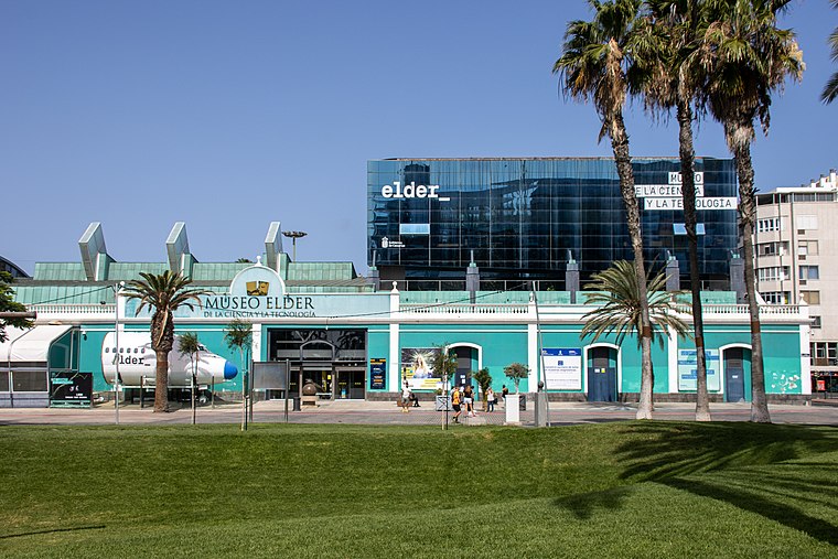
Photo: Mike Peel, CC BY-SA 4.0.
The Elder Museum of Science and Technology is a museum in Las Palmas de Gran Canaria, the capital city of Gran Canaria, in the Canary Islands. Elder Museum of Science and Technology is situated 1 km southwest of Federaçion Canaria de Bola Canaria y Petanca.
Places in the Area
Nearby places include La Isleta and Las Coloradas.


Ciudad Jardín
Suburb

Photo: Tolagorn, CC BY-SA 4.0.
Ciudad Jardín is a suburb, which is situated 3 km south of Federaçion Canaria de Bola Canaria y Petanca.
Federaçion Canaria de Bola Canaria y Petanca
- Type: School building
- Categories: building and education
- Location: Las Palmas, Las Palmas, Gran Canaria, Canary Islands, Spain, Iberia, Europe
- View on OpenStreetMap
Latitude
28.14883° or 28° 8′ 56″ northLongitude
-15.42231° or 15° 25′ 20″ westOpen location code
7CW64HXH+G3OpenStreetMap ID
way 278344255OpenStreetMap feature
building=school
This page is based on OpenStreetMap, Wikidata, and Wikimedia Commons.
We’d love your help improving our open data sources. Thank you for contributing.
Satellite Map
Discover Federaçion Canaria de Bola Canaria y Petanca from above in high-definition satellite imagery.
Notable Places Nearby
Highlights include Terminal Manuel Becerra and Plaza Ingeniero Manuel Becerra.
Nearby Places
Explore places such as Instituto de Educación Secundaria La Isleta and Tolón.
Gran Canaria: Must-Visit Destinations
Delve into Telde, Ingenio, Maspalomas, and Playa del Inglés.
Curious Schools to Discover
Uncover intriguing schools from every corner of the globe.
About Mapcarta. Data © OpenStreetMap contributors and available under the Open Database License". Text is available under the CC BY-SA 4.0 license, except for photos, directions, and the map. Photo: Gino maccanti, CC BY 2.0.