P3
P3 is a parking area in Munich, Upper Bavaria, Bavaria. P3 is situated nearby to the playground Naturspielplatz, as well as near Erlebnisspielplatz.| Tap on a place to explore it |
Places of Interest Nearby
Highlights include Waldfriedhof Solln and Pater-Rupert-Mayer-Gymnasium Pullach.
Waldfriedhof Solln
Cemetery

Photo: Usien, CC BY-SA 3.0.
Waldfriedhof Solln is a cemetery, which is situated 560 metres north of P3.
Pater-Rupert-Mayer-Gymnasium Pullach
School

Photo: Fllweissbr, CC BY-SA 4.0.
Pater-Rupert-Mayer-Gymnasium Pullach is a school, which is situated 430 metres southwest of P3.
Gebiet um das Kloster Warnberg mit anschließenden Waldstücken in Richtung Forstenried und Solln
Protected area

Photo: Gras-Ober, CC BY-SA 3.0.
Gebiet um das Kloster Warnberg mit anschließenden Waldstücken in Richtung Forstenried und Solln is a protected area, which is situated 740 metres northwest of P3.
Places in the Area
Nearby places include Pullach and Grünwald.
Pullach
Village

Photo: Wikimedia, CC BY-SA 3.0.
Pullach, officially Pullach i. Isartal, is a municipality in the district of Munich in Bavaria in Germany. It lies on the Isar Valley Railway and is served by the S 7 line of the Munich S-Bahn, at the Großhesselohe Isartalbahnhof, Pullach and Höllriegelskreuth railway stations.
Grünwald
Town
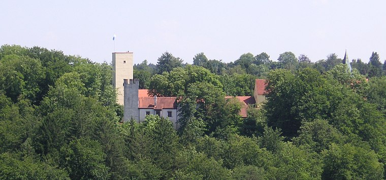
Photo: Wikimedia, CC BY-SA 3.0.
Grünwald is a municipality in the district of Munich, in the state of Bavaria, Germany. It is located on the right bank of the Isar, 12 km southwest of Munich.

P3
- Type: Parking area
- Parking: surface
- Category: transportation
- Location: Munich, Upper Bavaria, Bavaria, Germany, Central Europe, Europe
- View on OpenStreetMap
Latitude
48.0641° or 48° 3′ 51″ northLongitude
11.5154° or 11° 30′ 55″ eastOpen location code
8FWH3G78+J5OpenStreetMap ID
way 278689661OpenStreetMap feature
amenity=parkingOpenStreetMap attribute
parking=surface
This page is based on OpenStreetMap, Wikidata, and Wikimedia Commons.
We’d love your help improving our open data sources. Thank you for contributing.
Satellite Map
Discover P3 from above in high-definition satellite imagery.
Notable Places Nearby
Highlights include Naturspielplatz and Erlebnisspielplatz.
Nearby Places
Explore places such as Blindeninstitut (BIS) and Haus Debora Süd.
Munich: Must-Visit Destinations
Delve into North Munich, Altstadt, Haidhausen, and Ludwigsvorstadt-Isarvorstadt.
Curious Parking Areas to Discover
Uncover intriguing parking areas from every corner of the globe.
About Mapcarta. Data © OpenStreetMap contributors and available under the Open Database License". Text is available under the CC BY-SA 4.0 license, except for photos, directions, and the map. Photo: Heav84, CC BY-SA 3.0.