Wanderparkplatz Baßgeige
Wanderparkplatz Baßgeige is a parking area in Erkenbrechtsweiler, Landkreis Esslingen, Baden-Württemberg. Wanderparkplatz Baßgeige is situated nearby to Heidengraben südlicher, as well as near the town Owen.| Tap on a place to explore it |
Places of Interest Nearby
Highlights include Burg Sulzburg (Lautertal) and Freilichtmuseum Beuren.
Burg Sulzburg (Lautertal)
Castle

Photo: Stefan Karl, CC BY-SA 4.0.
Burg Sulzburg (Lautertal) is a castle, which is situated 1½ km east of Wanderparkplatz Baßgeige.
Freilichtmuseum Beuren
Museum

Photo: HelgeRieder, CC0.
Freilichtmuseum Beuren is situated 2 km northwest of Wanderparkplatz Baßgeige.
Hohenneuffen Castle

Photo: Wikimedia, CC BY-SA 2.0 de.
Hohenneuffen Castle is a large ruined castle in the northern foothills of the Swabian Alb, above the town of Neuffen in the district of Esslingen in Baden-Württemberg. Hohenneuffen Castle is situated 3 km west of Wanderparkplatz Baßgeige.
Places in the Area
Nearby places include Owen and Balzholz.
Owen
Town

Photo: Harke, CC BY-SA 3.0.
Owen is a town in the district of Esslingen in Baden-Württemberg in southern Germany. It is located 40 kilometres southeast of Stuttgart and 7 kilometres south of Kirchheim unter Teck. Owen is situated 3 km northeast of Wanderparkplatz Baßgeige.
Balzholz
Village

Photo: Roland1950, Public domain.
Balzholz is a village, which is situated 3½ km west of Wanderparkplatz Baßgeige.
Konradfels
Locality
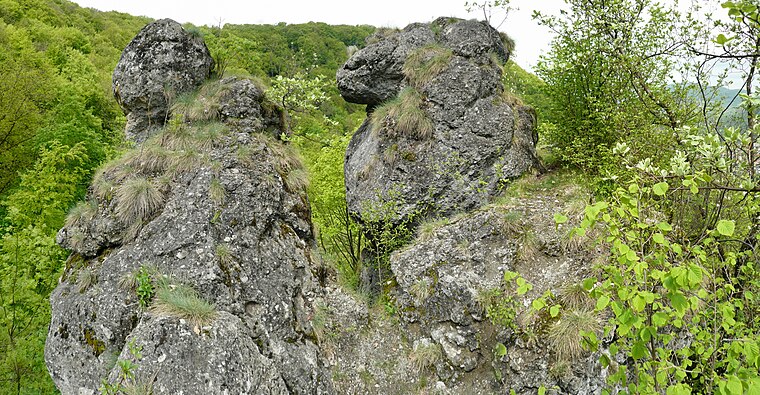
Photo: Ramessos, CC BY-SA 3.0.
Konradfels is a locality, which is situated 3½ km southeast of Wanderparkplatz Baßgeige.
Wanderparkplatz Baßgeige
- Type: Parking area
- Parking: surface
- Category: transportation
- Location: Erkenbrechtsweiler, Landkreis Esslingen, Stuttgart, Baden-Württemberg, Germany, Central Europe, Europe
- View on OpenStreetMap
Latitude
48.56265° or 48° 33′ 46″ northLongitude
9.43391° or 9° 26′ 2″ eastOpen location code
8FWFHC7M+3HOpenStreetMap ID
way 28010370OpenStreetMap feature
amenity=parkingOpenStreetMap attribute
parking=surface
This page is based on OpenStreetMap, Wikidata, and Wikimedia Commons.
We’d love your help improving our open data sources. Thank you for contributing.
Satellite Map
Discover Wanderparkplatz Baßgeige from above in high-definition satellite imagery.
Notable Places Nearby
Highlights include Heidengraben südlicher and Heidengraben.
Nearby Places
Explore places such as Wanderparkplatz Baßgeige and hochgehlegen.
Baden-Württemberg: Must-Visit Destinations
Delve into Stuttgart, Heidelberg, Karlsruhe, and Mannheim.
Curious Parking Areas to Discover
Uncover intriguing parking areas from every corner of the globe.
About Mapcarta. Data © OpenStreetMap contributors and available under the Open Database License". Text is available under the CC BY-SA 4.0 license, except for photos, directions, and the map. Photo: Traveler100, CC BY-SA 3.0.