Sport Balance
Sport Balance is a health club in Haltern am See, Recklinghausen, North Rhine-Westphalia which is located on Annabergstraße. Sport Balance is situated nearby to the chapel Annakapelle, as well as near the playground Spielplatz ‘Im Hohen Winkel’.| Tap on a place to explore it |
- Opening hours:
Monday—Friday: 8:00 AM—10:00 PM
Saturday, Sunday, and public holidays: 9:00 AM—6:00 PM - Type: Health club
- Address: Annabergstraße 63, Haltern am See, 45721
Places of Interest Nearby
Highlights include Westfälisches Römermuseum Haltern and Haltern am See station.
Westfälisches Römermuseum Haltern
Museum
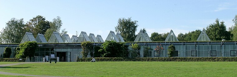
Photo: JosefLehmkuhl, Public domain.
Westfälisches Römermuseum Haltern is situated 790 metres north of Sport Balance.
Haltern am See station
Railway station
 Haltern am See station is a station in the town of Haltern am See in the German state of North Rhine-Westphalia on Wanne-Eickel–Hamburg railway from Wanne-Eickel to Hamburg. Haltern am See station is situated 1 km northeast of Sport Balance.
Holy Cross Church
Church

Photo: Chris06, CC BY-SA 4.0.
Holy Cross Church is situated 1¼ km south of Sport Balance.
Places in the Area
Nearby places include Pilgrimage area of Annaberg (Haltern am See) and Hamm-Bossendorf.
Pilgrimage area of Annaberg (Haltern am See)
Locality

Photo: Wikimedia, CC BY-SA 4.0.
Pilgrimage area of Annaberg (Haltern am See) is a locality.

Holtwick
Village

Photo: Stahlkocher, CC BY-SA 3.0.
Holtwick is a village, which is situated 3½ km northwest of Sport Balance.
Sport Balance
- Categories: building, recreation area, and sports location
- Location: Haltern am See, Recklinghausen, Münster, Münsterland, North Rhine-Westphalia, Germany, Central Europe, Europe
- View on OpenStreetMap
Latitude
51.73259° or 51° 43′ 57″ northLongitude
7.16939° or 7° 10′ 10″ eastOpen location code
9F39P5M9+2QOpenStreetMap ID
way 280112501OpenStreetMap feature
building=yesOpenStreetMap feature
leisure=fitness_centre
This page is based on OpenStreetMap, Wikidata, and Wikimedia Commons.
We’d love your help improving our open data sources. Thank you for contributing.
Satellite Map
Discover Sport Balance from above in high-definition satellite imagery.
Notable Places Nearby
Highlights include Annakapelle and Spielplatz ‘Im Hohen Winkel’.
Nearby Places
Explore places such as Getränke Paradies Prost and Prost Getränkemarkt.
Münsterland: Must-Visit Destinations
Delve into Münster, Bocholt, Dülmen, and Rheine.
Curious Health Clubs to Discover
Uncover intriguing health clubs from every corner of the globe.
About Mapcarta. Data © OpenStreetMap contributors and available under the Open Database License". Text is available under the CC BY-SA 4.0 license, except for photos, directions, and the map. Photo: Wikimedia, CC0.