Stadtverwaltung Mittweida
Stadtverwaltung Mittweida is a town hall in Mittweida, Mittelsachsen, Saxony which is located on Markt. Stadtverwaltung Mittweida is situated nearby to the fountain Friedensengel, as well as near the town hall Rathaus 2.| Tap on a place to explore it |
- Opening hours:
Monday and Tuesday: 9:00 AM—noon and 1:30 PM—4:00 PM
Thursday: 9:00 AM—noon and 1:30 PM—6:00 PM
Friday: 9:00 AM—noon
Saturday: 9:00 AM—11:00 AM - Email: stadtverwaltung@mittweida.de
- Type: Town hall
- Address: Markt 32, Mittweida, 09648
- Wheelchair access: yes
Places of Interest Nearby
Highlights include Polish-Saxon Post Milestone Mittweida and Alte Pfarrhäuser.
Polish-Saxon Post Milestone Mittweida
Historic site
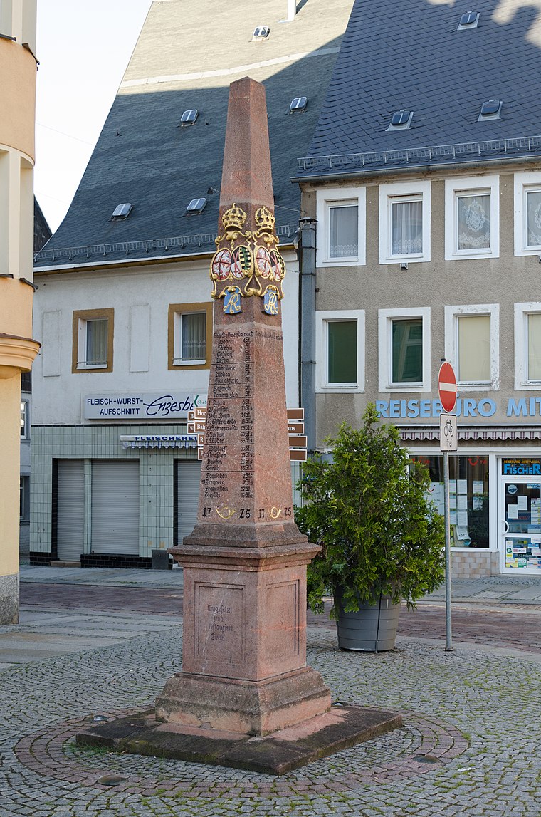
Photo: Tilman2007, CC BY-SA 3.0.
Polish-Saxon Post Milestone Mittweida is a historic site.
Alte Pfarrhäuser
Museum

Photo: Tilman2007, CC BY-SA 3.0.
Alte Pfarrhäuser is a museum, which is situated 190 metres southeast of Stadtverwaltung Mittweida.
Stadtkirche Unser lieben Frauen
Church

Photo: Lysippos, CC BY-SA 3.0.
Stadtkirche Unser lieben Frauen is a church, which is situated 260 metres south of Stadtverwaltung Mittweida.
Places in the Area
Nearby places include Altmittweida and Schönborn-Dreiwerden.
Altmittweida
Village
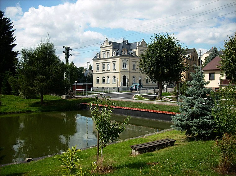
Photo: Jwaller, CC BY-SA 3.0.
Altmittweida is a municipality in the district of Mittelsachsen, in Saxony, Germany. Altmittweida is situated 2½ km southwest of Stadtverwaltung Mittweida.
Schönborn-Dreiwerden
Village

Photo: Brück & Sohn Kunstverlag Meißen, CC0.
Schönborn-Dreiwerden is a village, which is situated 3½ km southeast of Stadtverwaltung Mittweida.
Erlebach
Hamlet

Photo: Aagnverglaser, CC BY-SA 4.0.
Erlebach is a hamlet, which is situated 5 km northeast of Stadtverwaltung Mittweida.
Stadtverwaltung Mittweida
- Categories: building and government building
- Location: Mittweida, Mittelsachsen, Saxony, Germany, Central Europe, Europe
- View on OpenStreetMap
Latitude
50.98566° or 50° 59′ 8″ northLongitude
12.98044° or 12° 58′ 50″ eastInception
1851Open location code
9F2JXXPJ+75OpenStreetMap ID
way 281649181OpenStreetMap feature
amenity=townhallOpenStreetMap feature
building=yesOpenStreetMap attribute
wheelchair=yes
This page is based on OpenStreetMap, Wikidata, and Wikimedia Commons.
We’d love your help improving our open data sources. Thank you for contributing.
Satellite Map
Discover Stadtverwaltung Mittweida from above in high-definition satellite imagery.
Notable Places Nearby
Highlights include Friedensengel and Markt.
Nearby Places
Explore places such as Mittweidaer Information and Mittweida, Untere Rochlitzer Straße.
Saxony: Must-Visit Destinations
Delve into Dresden, Leipzig, Chemnitz, and Meißen.
Curious Town Halls to Discover
Uncover intriguing town halls from every corner of the globe.
About Mapcarta. Data © OpenStreetMap contributors and available under the Open Database License". Text is available under the CC BY-SA 4.0 license, except for photos, directions, and the map. Photo: Taxiarchos228, FAL.