Antiquitäten Peter Petrikat
Antiquitäten Peter Petrikat is an antique shop in Lüdenscheid, Märkischer Kreis, North Rhine-Westphalia which is located on Altenaer Straße. Antiquitäten Peter Petrikat is situated nearby to the peak Helle, as well as near the church Gemeindezentrum Rathmecke.| Tap on a place to explore it |
Places of Interest Nearby
Highlights include Fuelbecketalsperre and Phänomenta Lüdenscheid.

Phänomenta Lüdenscheid
Museum
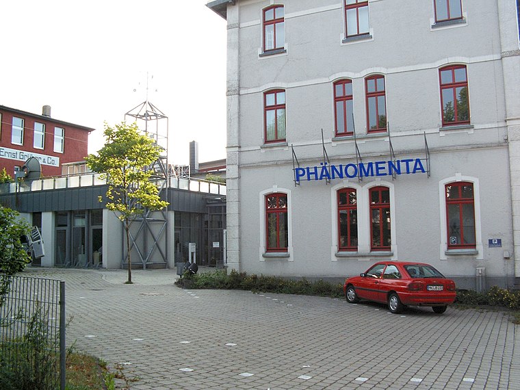
Photo: Silvercork, CC BY-SA 3.0.
Phänomenta Lüdenscheid is a museum, which is situated 3½ km south of Antiquitäten Peter Petrikat.
Maria Königin
Church
 Maria Königin is a church, which is situated 4 km south of Antiquitäten Peter Petrikat.
Places in the Area
Nearby places include Heedfeld and Kalve.
Heedfeld
Village

Photo: Mich.kramer, CC BY-SA 3.0.
Heedfeld is a village, which is situated 4 km west of Antiquitäten Peter Petrikat.
Kalve
Suburb

Photo: Mich.kramer, CC BY-SA 3.0.
Kalve is a suburb, which is situated 4½ km southeast of Antiquitäten Peter Petrikat.
Altena
Town

Photo: Asio otus, CC BY-SA 3.0.
Altena is a town in the district of Märkischer Kreis, North Rhine-Westphalia, Germany. The town's castle is the origin for the later Dukes of Berg. Altena is situated on the Lenne river valley, in the northern stretches of the Sauerland. Altena is situated 6 km northeast of Antiquitäten Peter Petrikat.
Antiquitäten Peter Petrikat
- Type: Antique shop
- Address: Altenaer Straße 273a, Lüdenscheid, 58513
- Categories: building and shop
- Location: Lüdenscheid, Märkischer Kreis, Arnsberg, South Westphalia, North Rhine-Westphalia, Germany, Central Europe, Europe
- View on OpenStreetMap
Latitude
51.25467° or 51° 15′ 17″ northLongitude
7.63787° or 7° 38′ 16″ eastOpen location code
9F397J3Q+V4OpenStreetMap ID
way 282936803OpenStreetMap feature
building=yesOpenStreetMap feature
shop=antiques
This page is based on OpenStreetMap, Wikidata, and Wikimedia Commons.
We’d love your help improving our open data sources. Thank you for contributing.
Satellite Map
Discover Antiquitäten Peter Petrikat from above in high-definition satellite imagery.
Notable Places Nearby
Highlights include Helle and Gemeindezentrum Rathmecke.
Nearby Places
Explore places such as Langenfeld and Langenfeld.
South Westphalia: Must-Visit Destinations
Delve into Siegen, Iserlohn, Soest, and Schmallenberg.
Curious Antique Shops to Discover
Uncover intriguing antique shops from every corner of the globe.
About Mapcarta. Data © OpenStreetMap contributors and available under the Open Database License". Text is available under the CC BY-SA 4.0 license, except for photos, directions, and the map. Photo: Wikimedia, CC0.