Spielplatz Thomasstraße
Spielplatz Thomasstraße is a playground in Hagen, Arnsberg, North Rhine-Westphalia. Spielplatz Thomasstraße is situated nearby to the church Maria Hilfe der Christen, as well as near Stephanuskirche.| Tap on a place to explore it |
Places of Interest Nearby
Highlights include Hagen Hauptbahnhof and Villa Post.
Hagen Hauptbahnhof
Railway station

Photo: Stefan Flöper, CC BY-SA 4.0.
Hagen Hauptbahnhof is a railway station serving the city of Hagen in western Germany. It is an important rail hub for the southeastern Ruhr area, offering regional and long distance connections. Hagen Hauptbahnhof is situated 1 km east of Spielplatz Thomasstraße.
Villa Post
College

Photo: Wikimedia, CC BY-SA 3.0.
Villa Post is a college, which is situated 1 km southeast of Spielplatz Thomasstraße.
Bunkermuseum Hagen
Museum
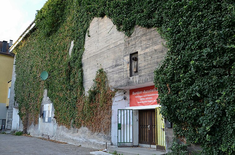
Photo: Bunker-Ausstellung, CC BY-SA 4.0.
Bunkermuseum Hagen is situated 1½ km east of Spielplatz Thomasstraße.
Places in the Area
Nearby places include Cunosiedlung and Altenhagen.


Spielplatz Thomasstraße
- Type: Playground
- Category: recreation area
- Location: Hagen, Arnsberg, Ruhr, North Rhine-Westphalia, Germany, Central Europe, Europe
- View on OpenStreetMap
Latitude
51.36123° or 51° 21′ 40″ northLongitude
7.44592° or 7° 26′ 45″ eastOpen location code
9F399C6W+F9OpenStreetMap ID
way 284925857OpenStreetMap feature
leisure=playground
This page is based on OpenStreetMap, Wikidata, and Wikimedia Commons.
We’d love your help improving our open data sources. Thank you for contributing.
Satellite Map
Discover Spielplatz Thomasstraße from above in high-definition satellite imagery.
Notable Places Nearby
Highlights include Maria Hilfe der Christen and Stephanuskirche.
Nearby Places
Explore places such as Georgstraße and Georgstraße.
Ruhr: Must-Visit Destinations
Delve into Dortmund, Essen, Duisburg, and Gelsenkirchen.
Curious Playgrounds to Discover
Uncover intriguing playgrounds from every corner of the globe.
About Mapcarta. Data © OpenStreetMap contributors and available under the Open Database License". Text is available under the CC BY-SA 4.0 license, except for photos, directions, and the map. Photo: Ennepetaler86, CC BY-SA 3.0.