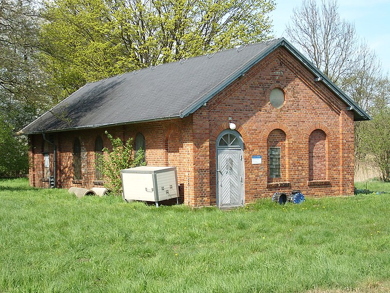
A6
A6 is an university building in Greifswald, Mecklenburg-Western Pomerania which is located on Fleischmannstraße. A6 is situated nearby to the church Johanneskirche Greifswald, as well as near the university Lerncafé.| Tap on a place to explore it |
- Type: University building
- Address: Fleischmannstraße 42-44, Greifswald, 17489
- Roof shape: hipped
Places of Interest Nearby
Highlights include Greifswald University Hospital and Volksstadion.
Greifswald University Hospital
Hospital
Greifswald University Hospital in Greifswald, Germany is a teaching hospital for the University of Greifswald's medical school. Greifswald University Hospital is owned and operated by a non-profit Anstalt des öffentlichen Rechts in cooperation with the university and serves as one of the primary hospitals in the state of Mecklenburg-Vorpommern. Greifswald University Hospital is situated 330 metres southeast of A6.
Volksstadion
Stadium

Photo: Muggmag, Copyrighted free use.
Volksstadion is a stadium, which is situated 1 km east of A6.
Theater und Stadthalle
Arts center

Photo: Erell, CC BY-SA 3.0.
Theater und Stadthalle is an arts center, which is situated 1 km northwest of A6.
Places in the Area
Nearby places include Koitenhagen and Groß Schönwalde.
Groß Schönwalde
Suburb

Photo: C.Löser, CC BY 3.0 de.
Groß Schönwalde is a suburb, which is situated 3½ km southeast of A6.
Neuenkirchen
Village

Photo: Skäpperöd, CC BY-SA 3.0.
Neuenkirchen is a municipality in the Vorpommern-Greifswald district, in Mecklenburg-Vorpommern, Germany. Neuenkirchen is situated 3½ km northwest of A6.
A6
- Categories: building and education
- Location: Greifswald, Vorpommern-Greifswald, Mecklenburg-Western Pomerania, Germany, Central Europe, Europe
- View on OpenStreetMap
Latitude
54.08976° or 54° 5′ 23″ northLongitude
13.40162° or 13° 24′ 6″ eastLevels
4Open location code
9F6M3CQ2+WJOpenStreetMap ID
way 285767365OpenStreetMap feature
building=universityOpenStreetMap attribute
roof-shape=hipped
This page is based on OpenStreetMap, Wikidata, and Wikimedia Commons.
We’d love your help improving our open data sources. Thank you for contributing.
Satellite Map
Discover A6 from above in high-definition satellite imagery.
Notable Places Nearby
Highlights include Johanneskirche Greifswald and Lerncafé.
Nearby Places
Explore places such as begreifbar - Lehr- und Lernzentrum der Universitätsmedizin Greifswald and Zentrum für Zahn-, Mund- und Kieferheilkunde.
Mecklenburg-Western Pomerania: Must-Visit Destinations
Delve into Schwerin, Rostock, Wismar, and Stralsund.
Curious University Buildings to Discover
Uncover intriguing university buildings from every corner of the globe.
About Mapcarta. Data © OpenStreetMap contributors and available under the Open Database License". Text is available under the CC BY-SA 4.0 license, except for photos, directions, and the map. Photo: Schiwago, CC BY 2.5.