Mittelwyden
Mittelwyden is a farm in Uesslingen-Buch, Frauenfeld District, Thurgau. Mittelwyden is situated nearby to the pond Schwarzmeerli, as well as near the nature reserve Im Bach.| Tap on a place to explore it |
Places of Interest Nearby
Highlights include St. Peter and Paul Parish Church and Kefikon Château.
St. Peter and Paul Parish Church
Church

Photo: Rauenstein, CC BY-SA 3.0.
St. Peter and Paul Parish Church is situated 1¼ km east of Mittelwyden.
Kefikon Château
Castle
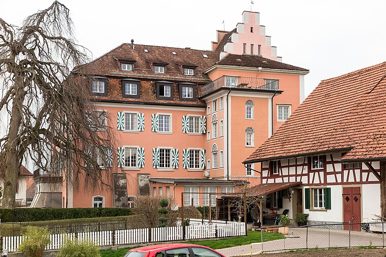
Photo: JoachimKohlerBremen, CC BY-SA 4.0.
Kefikon Château is a castle, which is situated 3½ km southeast of Mittelwyden.
Islikon railway station
Railway station

Photo: JoachimKohlerBremen, CC BY-SA 4.0.
Islikon railway station, or Gachnang-Islikon railway station, is a railway station in the Swiss canton of Thurgau and municipality of Gachnang. It takes its name from the adjacent village of Islikon. Islikon railway station is situated 4 km southeast of Mittelwyden.
Places in the Area
Nearby places include Uesslingen and Iselisberg.
Uesslingen
Village

Photo: gertrudis2010, CC BY-SA 3.0.
Uesslingen is a village and former municipality in the canton of Thurgau, Switzerland. In 1995, the municipality was merged with the neighboring municipality Buch bei Frauenfeld to form a new and larger municipality Uesslingen-Buch.
Iselisberg
Hamlet
 Iselisberg is a village in the canton of Thurgau, Switzerland. It is located just north of Uesslingen. In 1995, the Uesslingen municipality merged with its neighbor to form a new and larger municipality Uesslingen-Buch.
Ellikon an der Thur
Village

Photo: DidiWeidmann, CC BY-SA 3.0.
Ellikon an der Thur is a municipality in the district of Winterthur in the canton of Zürich in Switzerland.
Mittelwyden
- Type: Farm
- Category: agriculture
- Location: Uesslingen-Buch, Frauenfeld District, Thurgau, Switzerland, Central Europe, Europe
- View on OpenStreetMap
Latitude
47.57696° or 47° 34′ 37″ northLongitude
8.81504° or 8° 48′ 54″ eastOpen location code
8FVCHRG8+Q2OpenStreetMap ID
way 288393517OpenStreetMap feature
landuse=farmyard
This page is based on OpenStreetMap, Wikidata, and Wikimedia Commons.
We’d love your help improving our open data sources. Thank you for contributing.
Satellite Map
Discover Mittelwyden from above in high-definition satellite imagery.
Notable Places Nearby
Highlights include Schwarzmeerli and Im Bach.
Nearby Places
Explore places such as Mittelwyden and Unterwyden.
Switzerland: Must-Visit Destinations
Delve into Zurich, Berne, Geneva, and Basel.
Curious Farms to Discover
Uncover intriguing farms from every corner of the globe.
About Mapcarta. Data © OpenStreetMap contributors and available under the Open Database License". Text is available under the CC BY-SA 4.0 license, except for photos, directions, and the map. Photo: Simonizer, CC BY-SA 2.0 de.