Restaurant Les Cerniers
Restaurant Les Cerniers is a parking area in Monthey, Valais. Restaurant Les Cerniers is situated nearby to Les Giettes, as well as near the sports venue Centre Sportif Les Jeurs.| Tap on a place to explore it |
Places of Interest Nearby
Highlights include Dent de Valerette and Saint-Maurice Castle.

Saint-Maurice Castle
Castle

Photo: Roland Zumbühl, CC BY-SA 3.0.
Saint-Maurice Castle is a castle in the municipality of Saint-Maurice of the Canton of Valais in Switzerland. It is a Swiss heritage site of national significance. Saint-Maurice Castle is situated 3½ km east of Restaurant Les Cerniers.
St-Maurice railway station
Railway station
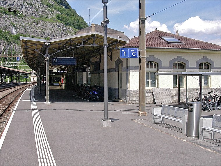
Photo: Albins, CC BY-SA 3.0.
St-Maurice railway station is a railway station in the municipality of Saint-Maurice, in the Swiss canton of Valais. It is an intermediate stop on the Simplon line and the terminus of the Saint-Gingolph–Saint-Maurice line. St-Maurice railway station is situated 3½ km east of Restaurant Les Cerniers.
Places in the Area
Nearby places include Vérossaz and Massongex.
Vérossaz
Village

Photo: Christoph Radtke, CC BY 3.0.
Vérossaz is a municipality in the district of Saint-Maurice, in the canton of Valais, Switzerland.
Massongex
Village

Photo: Espandero, CC BY-SA 4.0.
Massongex is a municipality in the district of Saint-Maurice, in the canton of Valais, Switzerland. Massongex is situated 3 km northeast of Restaurant Les Cerniers.
Troistorrents
Village

Photo: Espandero, CC BY-SA 4.0.
Troistorrents is a municipality in the district of Monthey in the canton of Valais in Switzerland. Troistorrents is situated 3½ km west of Restaurant Les Cerniers.
Restaurant Les Cerniers
- Type: Parking area
- Parking: surface
- Category: transportation
- Location: Monthey, Monthey District, Valais, Switzerland, Central Europe, Europe
- View on OpenStreetMap
Latitude
46.22286° or 46° 13′ 22″ northLongitude
6.95883° or 6° 57′ 32″ eastOpen location code
8FR86XF5+4GOpenStreetMap ID
way 288906236OpenStreetMap feature
amenity=parkingOpenStreetMap attribute
parking=surface
This page is based on OpenStreetMap, Wikidata, and Wikimedia Commons.
We’d love your help improving our open data sources. Thank you for contributing.
Satellite Map
Discover Restaurant Les Cerniers from above in high-definition satellite imagery.
Notable Places Nearby
Highlights include Les Cerniers and Les Giettes.
Nearby Places
Explore places such as Les Cerniers, restaurant and Restaurant les Cerniers.
Valais: Must-Visit Destinations
Delve into Sion, Zermatt, Martigny, and Brig.
Curious Parking Areas to Discover
Uncover intriguing parking areas from every corner of the globe.
About Mapcarta. Data © OpenStreetMap contributors and available under the Open Database License". Text is available under the CC BY-SA 4.0 license, except for photos, directions, and the map. Photo: Debugman, CC BY 3.0.