CherryBay Beach Club
CherryBay Beach Club is a bar in Zakynthos, Nomós Zakýnthou, Ionian Islands. CherryBay Beach Club is situated nearby to Euro Divers, as well as near the village Laganas.| Tap on a place to explore it |
Places of Interest Nearby
Highlights include Zakynthos International Airport.
Zakynthos International Airport
Aerodrome

Photo: SempreVolando, CC BY-SA 3.0.
Zakynthos International Airport "Dionysios Solomos" is an airport in Zakynthos, Greece. It is 4.3 km from Zakynthos town and close to other seaside tourist destinations such as Laganas, Tsilivi and Kalamaki. Zakynthos International Airport is situated 3½ km northeast of CherryBay Beach Club.
Places in the Area
Nearby places include Laganas and Lithakia.
Laganas
Village
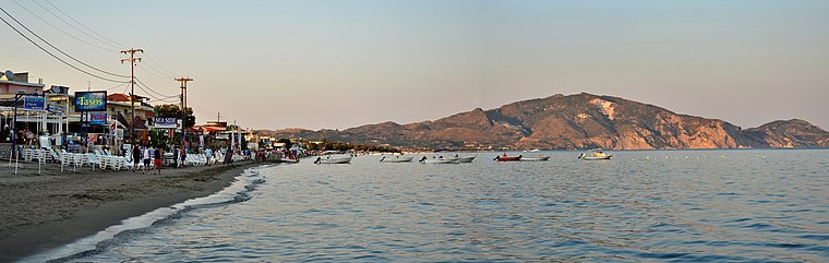
Photo: Σαλαμούρας Σπύρος, CC BY-SA 3.0.
Laganas is a village and a former municipality on the island of Zakynthos, Ionian Islands, Greece. Since the 2011 local government reform it is part of the municipality Zakynthos, of which it is a municipal unit.
Lithakia
Village
Lithakia is a village in the southern part of the island of Zakynthos, Greece. It is situated at the foot of low hills, about 2 km from the Ionian Sea coast. Lithakia is situated 3 km west of CherryBay Beach Club.
Ampelokipoi
Village
Ampelokipoi is a village and a local community in the southern part of the island of Zakynthos. It is part of the municipal unit of Zakynthos. The community includes the village Kalpaki. Ampelokipoi is situated 4 km north of CherryBay Beach Club.
CherryBay Beach Club
- Type: Bar
- Category: building
- Location: Zakynthos, Nomós Zakýnthou, Ionian Islands, Greece, Balkans, Europe
- View on OpenStreetMap
Latitude
37.72351° or 37° 43′ 25″ northLongitude
20.86526° or 20° 51′ 55″ eastOpen location code
8G92PVF8+C4OpenStreetMap ID
way 289002395OpenStreetMap feature
amenity=barOpenStreetMap feature
building=yes
This page is based on OpenStreetMap, Wikidata, and Wikimedia Commons.
We’d love your help improving our open data sources. Thank you for contributing.
Satellite Map
Discover CherryBay Beach Club from above in high-definition satellite imagery.
Notable Places Nearby
Highlights include Euro Divers and Doctor Laura Burca’s cabinet.
Nearby Places
Explore places such as Rita’s snack bar and Turtle.
Greece: Must-Visit Destinations
Delve into Athens, Thessaloniki, Lesvos, and Arcadia.
Curious Bars to Discover
Uncover intriguing bars from every corner of the globe.
About Mapcarta. Data © OpenStreetMap contributors and available under the Open Database License". Text is available under the CC BY-SA 4.0 license, except for photos, directions, and the map. Photo: Ggia, CC BY-SA 3.0.