Cornell Scott Hill Health Center
Cornell Scott Hill Health Center is a clinic in Town of New Haven, South Central Connecticut Planning Region, Connecticut which is located on Cedar Street. Cornell Scott Hill Health Center is situated nearby to the church New Lighthouse Ministries, as well as near Iglesia Cristiana.| Tap on a place to explore it |
- Type: Clinic
- Also known as: “South Central Rehabilitation Center”
- Address: 232 Cedar Street, New Haven, CT 06519
Places of Interest Nearby
Highlights include New Haven Railway Station and Yale New Haven Children’s Hospital.
New Haven Railway Station
Railway station
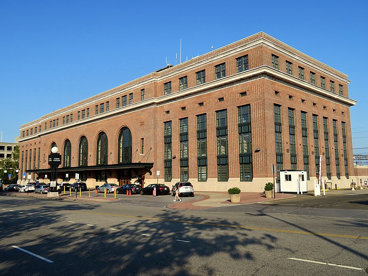
Photo: Pi.1415926535, CC BY-SA 3.0.
New Haven Union Station is the main railroad passenger station in New Haven, Connecticut. It is the third such station in the city of New Haven, preceded by both an 1848 built station in a different location, and an 1879 built station near the current station's location. New Haven Railway Station is situated 1,800 feet east of Cornell Scott Hill Health Center.
Yale New Haven Children’s Hospital
Hospital

Photo: YNHHEditor, CC BY-SA 3.0.
Yale New Haven Children's Hospital is a 202-bed pediatric acute care children's hospital located in New Haven, Connecticut. The hospital is affiliated with the Yale School of Medicine. Yale New Haven Children’s Hospital is situated 2,100 feet northwest of Cornell Scott Hill Health Center.
Beinecke Rare Book and Manuscript Library
Library
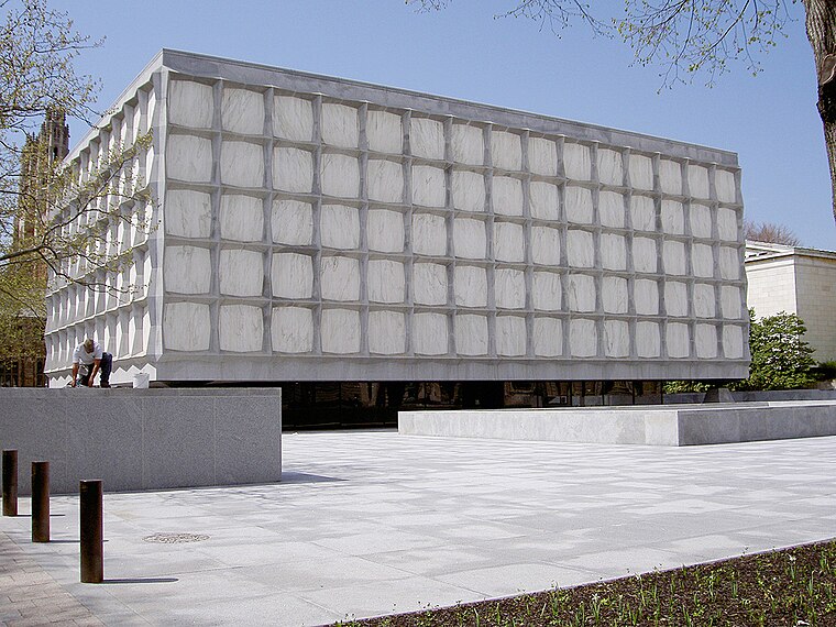
Photo: Wikimedia, Public domain.
The Beinecke Rare Book and Manuscript Library is the rare book library and literary archive of Yale University Library in New Haven, Connecticut. It is one of the largest buildings in the world dedicated to rare books and manuscripts and is one of the largest collections of such texts. Beinecke Rare Book and Manuscript Library is situated 1 mile north of Cornell Scott Hill Health Center.
Places in the Area
Nearby places include Trowbridge Square Historic District and Redfield & West Streets Historic District.
Trowbridge Square Historic District
Neighborhood

Photo: Emporostheoros, Public domain.
Trowbridge Square Historic District, originally known as Village of Spireworth and Mount Pleasant, is a well-preserved 19th-century neighborhood in the Hill section of New Haven, Connecticut.
Redfield & West Streets Historic District
Neighborhood
Redfield & West Streets Historic District is a state-designated historic district in New Haven, Connecticut. It is located in The Hill neighborhood in southern New Haven.
The Hill
Neighborhood
Photo: YNHHEditor, CC BY-SA 3.0.
The Hill is the southwesternmost neighborhood of New Haven, Connecticut. As early as 1800, this area was known as "Sodom Hill". Located directly south of Downtown New Haven, this neighborhood is home to residential areas, some light industry, New Haven Union Station as well as Yale-New Haven Hospital and the Yale School of Medicine.
Cornell Scott Hill Health Center
- Categories: health care and building
- Location: Town of New Haven, South Central Connecticut Planning Region, Connecticut, New England, United States, North America
- View on OpenStreetMap
Latitude
41.29909° or 41° 17′ 57″ northLongitude
-72.93289° or 72° 55′ 58″ westElevation
49 feet (15 metres)Operator
Cornell Scott Hill Health CenterOpen location code
87H973X8+JROpenStreetMap ID
way 289136019OpenStreetMap feature
amenity=clinicOpenStreetMap feature
building=yesOpenStreetMap feature
healthcare=clinic
This page is based on OpenStreetMap, Wikidata, and Wikimedia Commons.
We’d love your help improving our open data sources. Thank you for contributing.
Satellite Map
Discover Cornell Scott Hill Health Center from above in high-definition satellite imagery.
Places with the Same Name
Discover other places named “Cornell Scott Hill Health Center”.
Notable Places Nearby
Highlights include New Lighthouse Ministries and Iglesia Cristiana.
Nearby Places
Explore places such as Recovery and Wellness Center and Amistad Street Garage.
Connecticut: Must-Visit Destinations
Delve into Hartford, New Haven, Bridgeport, and Stamford.
Curious Clinics to Discover
Uncover intriguing clinics from every corner of the globe.
About Mapcarta. Data © OpenStreetMap contributors and available under the Open Database License". Text is available under the CC BY-SA 4.0 license, except for photos, directions, and the map. Photo: Wikimedia, CC0.