Die Pommes-Box
Die Pommes-Box is a fast food restaurant in Kerpen, Rhein-Erft-Kreis, North Rhine-Westphalia which is located on Stiftsstraße. Die Pommes-Box is situated nearby to the museum Geburtshaus Adolph Kolping, as well as near the church Johanneskirche.| Tap on a place to explore it |
- Type: Fast food restaurant
- Cuisine: German
- Address: Stiftsstraße 91, Kerpen, 50171
Places of Interest Nearby
Highlights include Johanneskirche and St. Martinus.
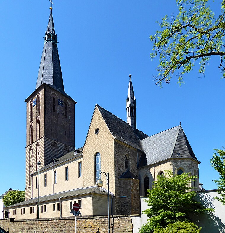
Johanneskirche
Church

Photo: Achim Raschka, CC BY-SA 4.0.
Johanneskirche is a church, which is situated 230 metres northeast of Die Pommes-Box.
St. Martinus
Church
 St. Martinus is a church, which is situated 410 metres northeast of Die Pommes-Box.
Jüdischer Friedhof
Cemetery
 Jüdischer Friedhof is a cemetery, which is situated 1½ km north of Die Pommes-Box.
Places in the Area
Nearby places include Kerpen and Mödrath.
Kerpen
Town

Photo: A.Savin, CC BY-SA 3.0.
Kerpen is the most populated town in the Rhein-Erft-Kreis. It is located about 20 kilometres southwest from Cologne. As of 2023, Kerpen has a total population of 67,627.
Mödrath
Village
 Mödrath is a quarter of Kerpen, Germany. It was annexed to the Kerpen Ortskern in the course of the lignite resettlement in 1956.

Die Pommes-Box
- Categories: building, food, and restaurant
- Location: Kerpen, Rhein-Erft-Kreis, Cologne District, North Rhine-Westphalia, Germany, Central Europe, Europe
- View on OpenStreetMap
Latitude
50.86793° or 50° 52′ 5″ northLongitude
6.68881° or 6° 41′ 20″ eastOpen location code
9F28VM9Q+5GOpenStreetMap ID
way 289175284OpenStreetMap feature
amenity=fast_foodOpenStreetMap feature
building=yesOpenStreetMap attribute
cuisine=german
This page is based on OpenStreetMap, Wikidata, and Wikimedia Commons.
We’d love your help improving our open data sources. Thank you for contributing.
Satellite Map
Discover Die Pommes-Box from above in high-definition satellite imagery.
Notable Places Nearby
Highlights include Geburtshaus Adolph Kolping and ...beim Blitz....
Nearby Places
Explore places such as Kerpen Kolping-Museum and St. Vinzenz.
North Rhine-Westphalia: Must-Visit Destinations
Delve into Cologne, Düsseldorf, Bonn, and Dortmund.
Curious Fast Food Restaurants to Discover
Uncover intriguing fast food restaurants from every corner of the globe.
About Mapcarta. Data © OpenStreetMap contributors and available under the Open Database License". Text is available under the CC BY-SA 4.0 license, except for photos, directions, and the map. Photo: Daniel Schwen, CC BY-SA 2.5.