Auberge de Thines
Auberge de Thines is a café in Malarce-sur-la-Thines, Arrondissement of Largentière, Auvergne-Rhône-Alpes which is located on Calade de Thines. Auberge de Thines is situated nearby to the community center Salle Polyvalente, as well as near the cemetery Cimetière de Thines.| Tap on a place to explore it |
- Type: Café
- Address: 90 Calade de Thines
- Wheelchair access: no
Places of Interest Nearby
Highlights include Église Notre-Dame de Thines and Ferme dite de l’Espinas.
Église Notre-Dame de Thines
Church

Photo: Patrice78500, CC BY-SA 3.0.
Église Notre-Dame de Thines is a church.
Ferme dite de l’Espinas
Farm

Photo: Kmyle, CC BY-SA 4.0.
Ferme dite de l’Espinas is a farm, which is situated 2 km west of Auberge de Thines.
Places in the Area
Nearby places include Pied-de-Borne and Gravières.
Pied-de-Borne
Village

Photo: Ophrys34, CC BY-SA 3.0.
Pied-de-Borne is a commune in the Lozère département in southern France. Pied-de-Borne is situated 6 km west of Auberge de Thines.
Gravières
Village

Photo: Patrice78500, CC BY-SA 3.0.
Gravières is a commune in the Ardèche department in southern France. Gravières is situated 9 km south of Auberge de Thines.
Payzac
Village
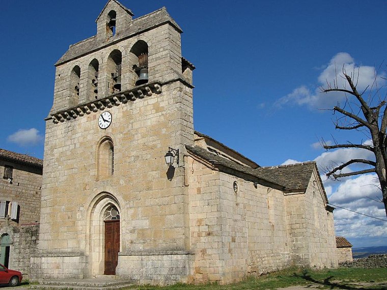
Photo: Raymondseneque, CC BY-SA 3.0.
Payzac is a commune in the Ardèche department in southern France. Payzac is situated 9 km southeast of Auberge de Thines.
Auberge de Thines
Latitude
44.49342° or 44° 29′ 36″ northLongitude
4.05113° or 4° 3′ 4″ eastOpen location code
8FP6F3V2+9FOpenStreetMap ID
way 289655921OpenStreetMap feature
amenity=cafeOpenStreetMap feature
building=yesOpenStreetMap attribute
wheelchair=no
This page is based on OpenStreetMap, Wikidata, and Wikimedia Commons.
We’d love your help improving our open data sources. Thank you for contributing.
Satellite Map
Discover Auberge de Thines from above in high-definition satellite imagery.
Notable Places Nearby
Highlights include Salle Polyvalente and Cimetière de Thines.
Nearby Places
Explore places such as Gîte rural l’Ermitage and Gîte d’étape communal de Thines.
Ardèche and Drôme: Must-Visit Destinations
Delve into Die, Vallon-Pont-d’Arc, Buis-les-Baronnies, and Lagorce.
Curious Cafés to Discover
Uncover intriguing cafés from every corner of the globe.
About Mapcarta. Data © OpenStreetMap contributors and available under the Open Database License". Text is available under the CC BY-SA 4.0 license, except for photos, directions, and the map. Photo: Perreal, CC BY-SA 3.0.