Hierros de Navarra
Hierros de Navarra is an industrial building in Olite/Erriberri, Navarre. Hierros de Navarra is situated nearby to the village Olite, as well as near the town Tafalla.| Tap on a place to explore it |
Places of Interest Nearby
Highlights include Erriberri/Olite railway station and Santa María la Real, Olite.
Erriberri/Olite railway station
Railway station
 Erriberri/Olite railway station is situated 2 km southeast of Hierros de Navarra.
Santa María la Real, Olite
Church
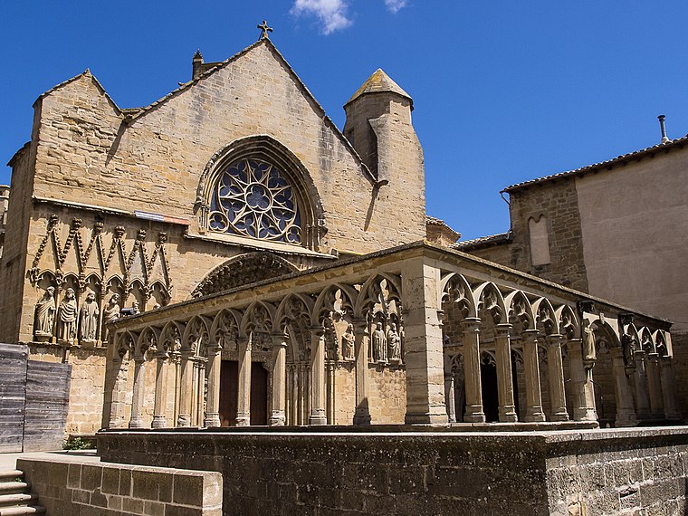 Santa María la Real is a Gothic-style Roman Catholic church, located on Plaza Plaza Teobaldos 1 in Olite, region of Navarre, Spain. Santa María la Real, Olite is situated 2 km southeast of Hierros de Navarra.
Tafalla train station
Railway station

Photo: Jean-Pierre Vergez-Larrouy, CC BY-SA 3.0.
Tafalla train station is a railway station, which is situated 3 km north of Hierros de Navarra.
Places in the Area
Nearby places include Olite and Tafalla.
Olite
Village

Photo: César Viteri Ramirez, CC BY-SA 2.0.
Erriberri is a town and municipality located in the Tafalla comarca, Erriberri merindad, in Navarre, Basque Country.

Beire
Village

Photo: Jialxv, CC BY-SA 4.0.
Beire is a town and municipality located in the province and autonomous community of Navarre, northern Spain. Beire is situated 6 km southeast of Hierros de Navarra.
Hierros de Navarra
- Type: Industrial building
- Categories: building, factory, and industry
- Location: Olite/Erriberri, Navarre, Northern Spain, Spain, Iberia, Europe
- View on OpenStreetMap
Latitude
42.49702° or 42° 29′ 49″ northLongitude
-1.66398° or 1° 39′ 50″ westOpen location code
8CJWF8WP+RCOpenStreetMap ID
way 290086468OpenStreetMap feature
building=industrialOpenStreetMap feature
man_made=works
This page is based on OpenStreetMap, Wikidata, and Wikimedia Commons.
We’d love your help improving our open data sources. Thank you for contributing.
Satellite Map
Discover Hierros de Navarra from above in high-definition satellite imagery.
Notable Places Nearby
Highlights include Bodegas Marco Real and Bodegas Piedemonte.
Nearby Places
Explore places such as El Caserio de Tafalla and Cetya.
Navarre: Must-Visit Destinations
Delve into Pamplona, Roncesvalles, and Uterga.
Curious Industrial Buildings to Discover
Uncover intriguing industrial buildings from every corner of the globe.
About Mapcarta. Data © OpenStreetMap contributors and available under the Open Database License". Text is available under the CC BY-SA 4.0 license, except for photos, directions, and the map. Photo: Artsuaga, CC BY-SA 3.0.