I
I is a parking area in Salles-la-Source, Arrondissement of Rodez, Occitanie. I is situated nearby to the social club Les Ailes Ruthénoises, as well as near Av’airon club.| Tap on a place to explore it |
Places of Interest Nearby
Highlights include Rodez-Marcillac Airport and Dolmen of Pérignagol.
Rodez-Marcillac Airport
Aerodrome
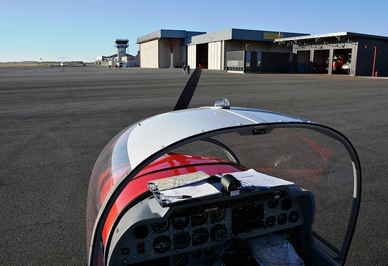
Photo: Lécuyer-couqueberg, CC BY-SA 4.0.
Rodez–Aveyron Airport is a French regional airport, located on the territory of the commune of Salles-la-Source approximately 10 km outside the centre of Rodez, the departmental capital of Aveyron, France.
Dolmen of Pérignagol
Archaeological site
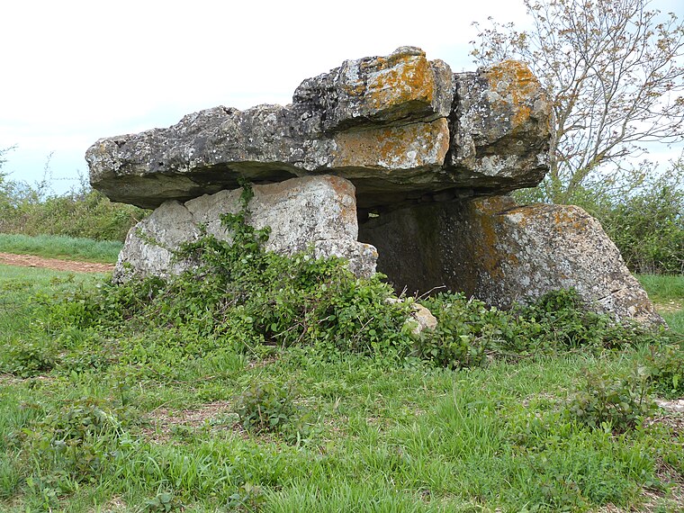
Photo: Thérèse Gaigé, CC BY-SA 4.0.
Dolmen of Pérignagol is an archaeological site, which is situated 2½ km northwest of I.
Dolmen de Seveyrac
Archaeological site

Photo: Tournasol7, CC BY-SA 4.0.
Dolmen de Seveyrac is an archaeological site, which is situated 2½ km northwest of I.
Places in the Area
Nearby places include Balsac and Salles-la-Source.
Balsac
Village

Photo: Thérèse Gaigé, CC BY-SA 4.0.
Balsac is a village in the Aveyron department in the Occitanie region of southern France. It was merged into the new commune of Druelle Balsac on 1 January 2017. Balsac is situated 3½ km west of I.
Salles-la-Source
Village

Photo: Kallerna, CC BY-SA 4.0.
Salles-la-Source, historically Salles-Comtaux, is a commune in the Aveyron department in the Occitania region in Southern France. Rodez–Aveyron Airport is largely located in Salles-la-Source. Salles-la-Source is situated 4 km northeast of I.
Druelle
Village
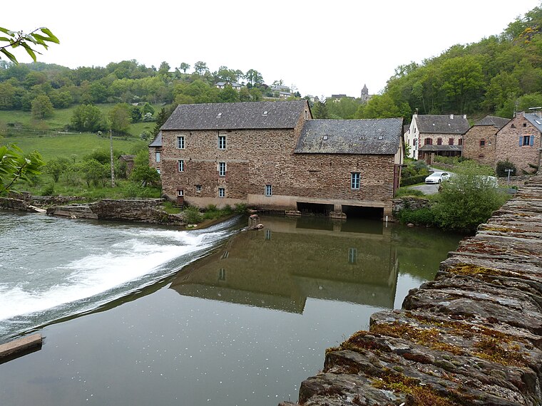
Photo: Thérèse Gaigé, CC BY-SA 4.0.
Druelle is a former commune in the Aveyron department in southern France. On 1 January 2017, it was merged into the new commune Druelle Balsac. Druelle is situated 6 km south of I.
I
- Type: Parking area
- Parking: surface
- Category: transportation
- Location: Salles-la-Source, Arrondissement of Rodez, Aveyron, Occitanie, France, Europe
- View on OpenStreetMap
Latitude
44.41026° or 44° 24′ 37″ northLongitude
2.48495° or 2° 29′ 6″ eastOpen location code
8FP4CF6M+4XOpenStreetMap ID
way 293182703OpenStreetMap feature
amenity=parkingOpenStreetMap attribute
parking=surface
This page is based on OpenStreetMap, Wikidata, and Wikimedia Commons.
We’d love your help improving our open data sources. Thank you for contributing.
Satellite Map
Discover I from above in high-definition satellite imagery.
Notable Places Nearby
Highlights include Les Ailes Ruthénoises and Av’airon club.
Nearby Places
Explore places such as H and G.
Curious Parking Areas to Discover
Uncover intriguing parking areas from every corner of the globe.
About Mapcarta. Data © OpenStreetMap contributors and available under the Open Database License". Text is available under the CC BY-SA 4.0 license, except for photos, directions, and the map. Photo: Inkey, Public domain.