Gîte du Haïl
Gîte du Haïl is a chalet in Clarens, Arrondissement of Bagnères-de-Bigorre, Occitanie which is located on L’Estelou. Gîte du Haïl is situated nearby to the pitch Boulodrome, as well as near the community center Salle des fêtes.| Tap on a place to explore it |
Places of Interest Nearby
Highlights include Église Saint-André de Clarens and Église Saint-Barthélemy d’Uglas.
Église Saint-André de Clarens
Church

Photo: Florent Pécassou, CC BY-SA 3.0.
Église Saint-André de Clarens is a church, which is situated 490 metres northeast of Gîte du Haïl.
Église Saint-Barthélemy d’Uglas
Church

Photo: Sotos, CC BY-SA 4.0.
Église Saint-Barthélemy d’Uglas is a church, which is situated 3 km southeast of Gîte du Haïl.
Église Saint-Michel de Campistrous
Church

Photo: Sotos, CC BY-SA 4.0.
Église Saint-Michel de Campistrous is a church, which is situated 3 km west of Gîte du Haïl.
Places in the Area
Nearby places include Campistrous and Lannemezan.
Campistrous
Village

Photo: Sotos, CC BY-SA 4.0.
Campistrous is a commune in the Hautes-Pyrénées department in south-western France. Campistrous is situated 3 km west of Gîte du Haïl.
Lannemezan
Village
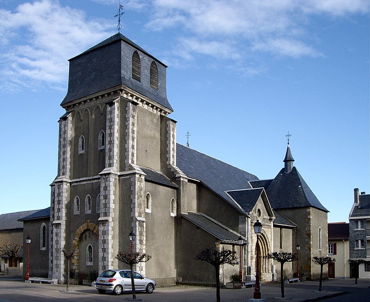
Photo: Florent Pécassou, CC BY-SA 3.0.
Lannemezan is a commune in the Hautes-Pyrénées department and the Occitanie region in south-western France. The inhabitants are called Lannemezanais. Lannemezan is the largest city in the Communauté de communes du Plateau de Lannemezan. Lannemezan is situated 4½ km southwest of Gîte du Haïl.
Houeydets
Village

Photo: Sotos, CC BY-SA 4.0.
Houeydets is a commune in the Hautes-Pyrénées department in south-western France. Houeydets is situated 4½ km west of Gîte du Haïl.
Gîte du Haïl
- Type: Chalet
- Address: 1 L’Estelou, Clarens, 65300
- Categories: building, tourism, and accommodation
- Location: Clarens, Arrondissement of Bagnères-de-Bigorre, Hautes-Pyrénées, Occitanie, France, Europe
- View on OpenStreetMap
Latitude
43.16047° or 43° 9′ 38″ northLongitude
0.41035° or 0° 24′ 37″ eastOpen location code
8FM25C66+54OpenStreetMap ID
way 294857829OpenStreetMap feature
building=yesOpenStreetMap feature
tourism=chalet
This page is based on OpenStreetMap, Wikidata, and Wikimedia Commons.
We’d love your help improving our open data sources. Thank you for contributing.
Satellite Map
Discover Gîte du Haïl from above in high-definition satellite imagery.
Notable Places Nearby
Highlights include Boulodrome and Salle des fêtes.
Nearby Places
Explore places such as École de Clarens and Aire de l’Hount Deth Bosc.
Hautes-Pyrénées: Must-Visit Destinations
Delve into Lourdes, Tarbes, Bagnères-de-Bigorre, and Pyrénées National Park.
Curious Chalets to Discover
Uncover intriguing chalets from every corner of the globe.
About Mapcarta. Data © OpenStreetMap contributors and available under the Open Database License". Text is available under the CC BY-SA 4.0 license, except for photos, directions, and the map. Photo: JLPC, CC BY-SA 3.0.