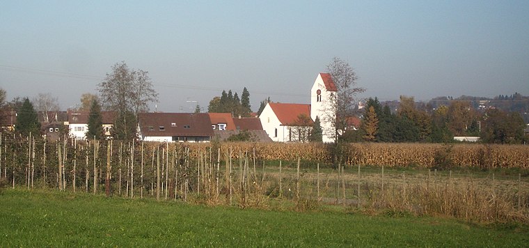
Kapelle St. Andreas
Kapelle St. Andreas is a church in Ravensburg, Tübingen Region, Baden-Württemberg. Kapelle St. Andreas is situated nearby to the pond Mühlenweiher, as well as near the prison Justizvollzugsanstalt Ravensburg.| Tap on a place to explore it |
- Type: Church
- Denomination: Roman Catholic
- Address: 46, Knollengraben, Ravensburg
Places of Interest Nearby
Highlights include Justizvollzugsanstalt Ravensburg and Flappachweiher.
Justizvollzugsanstalt Ravensburg
Prison

Photo: Carsten Steger, CC BY-SA 4.0.
Justizvollzugsanstalt Ravensburg is a prison, which is situated 790 metres north of Kapelle St. Andreas.
Flappachweiher
Pond

Photo: Wikimedia, Public domain.
Flappachweiher is a pond, which is situated 1½ km south of Kapelle St. Andreas.
Kemmerlanger Moos
Nature reserve

Photo: Manfred Walser, CC BY-SA 4.0.
Kemmerlanger Moos is a nature reserve.
Places in the Area
Nearby places include Grünkraut and Oberhofen.
Grünkraut
Village

Photo: Roland Nonnenmacher, CC BY-SA 3.0.
Grünkraut is a town in the district of Ravensburg in Baden-Württemberg in Germany. Grünkraut is situated 3 km southeast of Kapelle St. Andreas.

Kapelle St. Andreas
- Categories: building, chapel, place of worship, and religion
- Location: Ravensburg, Ravensburg, Tübingen Region, Bodensee Region, Baden-Württemberg, Germany, Central Europe, Europe
- View on OpenStreetMap
Latitude
47.76158° or 47° 45′ 42″ northLongitude
9.62963° or 9° 37′ 47″ eastOpen location code
8FVFQJ6H+JVOpenStreetMap ID
way 295308003OpenStreetMap feature
amenity=place_of_worshipOpenStreetMap feature
building=chapelOpenStreetMap attribute
denomination=roman_catholic
This page is based on OpenStreetMap, Wikidata, and Wikimedia Commons.
We’d love your help improving our open data sources. Thank you for contributing.
Satellite Map
Discover Kapelle St. Andreas from above in high-definition satellite imagery.
Places with the Same Name
Discover other places named “Kapelle St. Andreas”.
Notable Places Nearby
Highlights include Mühlenweiher and Volleyballfeld Flappachbad.
Nearby Places
Explore places such as Ravensburg Abzweigung Flappach and Ravensburg Abzweigung Flappach.
Bodensee Region: Must-Visit Destinations
Delve into Konstanz, Friedrichshafen, Sigmaringen, and Überlingen.
Curious Churches to Discover
Uncover intriguing churches from every corner of the globe.
About Mapcarta. Data © OpenStreetMap contributors and available under the Open Database License". Text is available under the CC BY-SA 4.0 license, except for photos, directions, and the map. Photo: Wikimedia, CC BY 3.0.