Mátyás király vadászkastélya
Mátyás király vadászkastélya is an archaeological site in Pest County, Central Hungary. Mátyás király vadászkastélya is situated nearby to the spring Kutyavári-forrás, as well as near Keserűfű utcai forrásfoglalás.| Tap on a place to explore it |
- Type: Archaeological site
- Also known as: “Érdi Kutyavár”
- Address: 11997
Places of Interest Nearby
Highlights include Kutyavár and Beehive stone.

Beehive stone
Nature reserve
Beehive stones or beehive rocks of Hungary are rock formations, often naturally conical towers, with niches or cavities carved into their sides. A limited number of rocks with niches can be found even close to Budapest, in the area of the Pilis mountains and the Budai-hegység hills, especially on its Tétényi-fennsík plateau.
Diósdi Római Cave
Cave
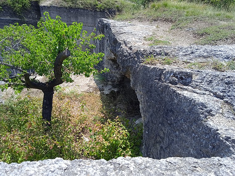
Photo: Szenti Tamás, CC BY-SA 4.0.
Diósdi Római Cave is situated 1½ km north of Mátyás király vadászkastélya.
Places in the Area
Nearby places include Érd and Törökbálint.
Érd
Photo: Elekes Andor, CC BY-SA 4.0.
Érd is a suburb just southwest of Budapest in Pest County. It has the largest population in Pest County with about 67,000 inhabitants.
Törökbálint

Photo: Globetrotter19, CC BY-SA 3.0.
Törökbálint is a town in Pest County, 15 km westwards from Budapest. Neighboring town Diósd is also described here.
Budaörs

Photo: Grin, CC BY-SA 3.0.
Budaörs is a town in Pest County, west of District 11, Budapest metropolitan area, and has about 28,400 inhabitants. The town lies among the Buda Hills and the Tétény Plateau in the Budaörs Basin. The town is split by M1, M7 motorways.
Mátyás király vadászkastélya
- Categories: historic site, meadow, tourist attraction, and tourism
- Location: Pest County, Central Hungary, Hungary, Central Europe, Europe
- View on OpenStreetMap
Latitude
47.39764° or 47° 23′ 52″ northLongitude
18.92934° or 18° 55′ 46″ eastOpen location code
8FVW9WXH+3POpenStreetMap ID
way 295640758OpenStreetMap feature
historic=archaeological_siteOpenStreetMap feature
landuse=meadow
This page is based on OpenStreetMap, Wikidata, and Wikimedia Commons.
We’d love your help improving our open data sources. Thank you for contributing.
Satellite Map
Discover Mátyás király vadászkastélya from above in high-definition satellite imagery.
Notable Places Nearby
Highlights include Kutyavári-forrás and Keserűfű utcai forrásfoglalás.
Nearby Places
Explore places such as Országzászló emlékmű and Mikroszkóp szerviz.
Pest County: Must-Visit Destinations
Delve into Érd, Cegléd, Gödöllő, and Budaörs.
Curious Archaeological Sites to Discover
Uncover intriguing archaeological sites from every corner of the globe.
About Mapcarta. Data © OpenStreetMap contributors and available under the Open Database License". Text is available under the CC BY-SA 4.0 license, except for photos, directions, and the map. Photo: ucsendre, CC BY-SA 3.0.