Fleurs de Verveine
Fleurs de Verveine is a greenhouse in Rosières, Arrondissement du Puy-en-Velay, Auvergne-Rhône-Alpes which is located on Route du Pertuis Rougeac. Fleurs de Verveine is situated nearby to the peak Suc de Rougeac, as well as near Suc de la Mure.| Tap on a place to explore it |
Places of Interest Nearby
Highlights include Église Saint-Martin de Rosières and Ravines of Corbœuf.
Église Saint-Martin de Rosières
Church

Photo: Jackydarne, CC BY-SA 4.0.
Église Saint-Martin de Rosières is a church, which is situated 2½ km northwest of Fleurs de Verveine.
Ravines of Corbœuf

Photo: Skipper69, CC BY-SA 3.0.
Ravines of Corbœuf is situated 2 km north of Fleurs de Verveine.
Château d’Adiac
Castle
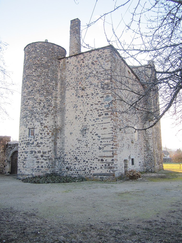
Photo: KooK, CC BY-SA 3.0.
Château d’Adiac is a castle, which is situated 3½ km northwest of Fleurs de Verveine.
Places in the Area
Nearby places include Malrevers and Saint-Étienne-Lardeyrol.
Malrevers
Village

Photo: Eponimm, CC BY-SA 4.0.
Malrevers is a commune in the Haute-Loire department in south-central France. Malrevers is situated 3½ km southwest of Fleurs de Verveine.
Saint-Étienne-Lardeyrol
Village

Photo: Ludo29, CC BY-SA 3.0.
Saint-Étienne-Lardeyrol is a commune in the Haute-Loire department in south-central France. Saint-Étienne-Lardeyrol is situated 4½ km south of Fleurs de Verveine.
Beaulieu
Village
Photo: Illaum, CC BY-SA 3.0.
Beaulieu is a commune in the Haute-Loire department and Auvergne-Rhône-Alpes region of south-east central France. Beaulieu is situated 5 km west of Fleurs de Verveine.
Fleurs de Verveine
- Type: Greenhouse
- Address: Route du Pertuis Rougeac, Rosières, 43800
- Category: building
- Location: Rosières, Arrondissement du Puy-en-Velay, Haute-Loire, Auvergne-Rhône-Alpes, France, Europe
- View on OpenStreetMap
Latitude
45.11148° or 45° 6′ 41″ northLongitude
4.00321° or 4° 0′ 12″ eastOpen location code
8FQ64263+H7OpenStreetMap ID
way 295937542OpenStreetMap feature
building=greenhouse
This page is based on OpenStreetMap, Wikidata, and Wikimedia Commons.
We’d love your help improving our open data sources. Thank you for contributing.
Satellite Map
Discover Fleurs de Verveine from above in high-definition satellite imagery.
Notable Places Nearby
Highlights include Suc de Rougeac and Suc de la Mure.
Nearby Places
Explore places such as Rougeac and Monteillard.
Auvergne-Rhône-Alpes: Must-Visit Destinations
Delve into Lyon, Grenoble, Clermont-Ferrand, and Saint-Étienne.
Curious Greenhouses to Discover
Uncover intriguing greenhouses from every corner of the globe.
About Mapcarta. Data © OpenStreetMap contributors and available under the Open Database License". Text is available under the CC BY-SA 4.0 license, except for photos, directions, and the map. Photo: Pedelecs, CC BY-SA 3.0.