Müggelschlößchen-Schule
Müggelschlößchen-Schule is a school in Berlin, Germany which is located on Alfred-Randt-Straße. Müggelschlößchen-Schule is situated nearby to the community center Jugendclub Würfel, as well as near the sports venue Turnhalle.| Tap on a place to explore it |
- Type: School
- Address: Alfred-Randt-Straße 54-56, Köpenick, Berlin, 12559
- Wheelchair access: yes
Places of Interest Nearby
Highlights include German Red Cross Hospital Berlin Köpenick and Sundial.
German Red Cross Hospital Berlin Köpenick
Hospital
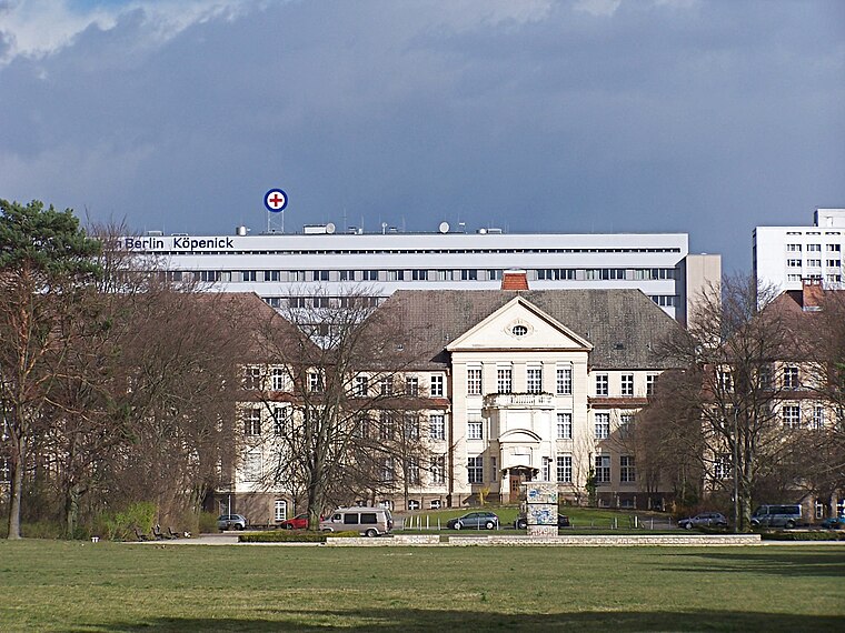
Photo: Wikimedia, CC BY-SA 3.0.
German Red Cross Hospital Berlin Köpenick is situated 640 metres west of Müggelschlößchen-Schule.
Sundial
Work of art

Photo: Singlespeedfahrer, CC0.
Sundial is a work of art, which is situated 370 metres west of Müggelschlößchen-Schule.
Volkspark Köpenick
Park

Photo: Singlespeedfahrer, CC0.
Volkspark Köpenick is situated 1 km west of Müggelschlößchen-Schule.
Places in the Area
Nearby places include Salvador-Allende-Viertel II and Treptow-Köpenick.
Salvador-Allende-Viertel II
Quarter

Photo: Brücke-Osteuropa, CC0.
Salvador-Allende-Viertel II is a quarter.
Treptow-Köpenick
Treptow-Köpenick is in the southeast of Berlin. Köpenick is known for its old town, its castle and the many lakes and forests. And for the story of The Captain of Köpenick.Hirschgarten
Neighborhood

Photo: Fridolin freudenfett, CC BY-SA 4.0.
Hirschgarten is a neighborhood.
Müggelschlößchen-Schule
- Category: education
- Location: Berlin, Germany, Central Europe, Europe
- View on OpenStreetMap
Latitude
52.43913° or 52° 26′ 21″ northLongitude
13.60506° or 13° 36′ 18″ eastOperator
Land BerlinOpen location code
9F4MCJQ4+M2OpenStreetMap ID
way 296141625OpenStreetMap feature
amenity=schoolOpenStreetMap attribute
wheelchair=yes
This page is based on OpenStreetMap, Wikidata, and Wikimedia Commons.
We’d love your help improving our open data sources. Thank you for contributing.
Satellite Map
Discover Müggelschlößchen-Schule from above in high-definition satellite imagery.
Notable Places Nearby
Highlights include Jugendclub Würfel and Turnhalle.
Nearby Places
Explore places such as Flüchtlingsheim Allendeviertel and Humanistische Kindertagesstätte Rappelkiste.
Berlin: Must-Visit Destinations
Delve into Mitte, East Central, City West, and East Berlin.
Curious Schools to Discover
Uncover intriguing schools from every corner of the globe.
About Mapcarta. Data © OpenStreetMap contributors and available under the Open Database License". Text is available under the CC BY-SA 4.0 license, except for photos, directions, and the map. Photo: Berthold Werner, CC BY-SA 3.0.