Barteldes, Hartig Building
Barteldes, Hartig Building is a building in City and County of Denver, Colorado which is located on Wynkoop Street. Barteldes, Hartig Building is situated nearby to the art gallery David B Smith Gallery, as well as near Sloane Gallery of Art.| Tap on a place to explore it |
Places of Interest Nearby
Highlights include Denver Union Station and Ball Arena.
Denver Union Station

Photo: Darkshark0159, Public domain.
Denver Union Station is the main railway station and central transportation hub in Denver, Colorado. It is located at 17th and Wynkoop Streets in the present-day LoDo district and includes the historic station house, a modern open-air train shed, a 22-gate underground bus station, and light rail station. Denver Union Station is situated 520 feet north of Barteldes, Hartig Building.
Ball Arena
Stadium
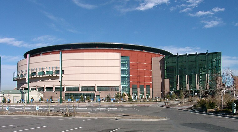
Photo: Wikimedia, CC BY-SA 2.5.
Ball Arena is a multi-purpose indoor arena located in Denver, Colorado, United States. It is situated at Speer Boulevard, a main thoroughfare in downtown Denver, and is served by two nearby exits off Interstate 25. Ball Arena is situated 2,300 feet southwest of Barteldes, Hartig Building.
Museum of Contemporary Art Denver
Museum

Photo: David Shankbone, CC BY 3.0.
The Museum of Contemporary Art, in Denver, Colorado, was founded in 1996 as the first dedicated home for contemporary art in the city of Denver. For seven years, MCA Denver occupied a renovated fish market in Sakura Square in lower downtown Denver. Museum of Contemporary Art Denver is situated 1,100 feet west of Barteldes, Hartig Building.
Places in the Area
Nearby places include LoDo and Union Station.
LoDo
Neighborhood

Photo: Wikimedia, CC BY-SA 3.0.
LoDo is an unofficial neighborhood in Denver, Colorado, and is one of the oldest places of settlement in the city. It is a mixed-use historic district, known for its nightlife, and serves as an example of success in urban reinvestment and revitalization.
Union Station
Neighborhood

Photo: Denverjeffrey, CC BY-SA 3.0.
Union Station is a downtown neighborhood of Denver, Colorado. In 2020, the population of the neighborhood was roughly 5,878. The neighborhood is named for Union Station, Denver's main railroad terminal.
Auraria
Neighborhood

Photo: Denverjeffrey, CC BY-SA 3.0.
Auraria was a gold mining camp established in 1858 in the Kansas Territory of the United States. Today it survives in its original location as a neighborhood of Denver, Colorado, immediately south of the confluence of Cherry Creek and the South Platte River.
Barteldes, Hartig Building
- Type: Commercial building
- Address: 1600 Wynkoop Street, Denver, CO 80202
- Categories: building and office
- Location: City and County of Denver, Colorado, Rocky Mountains, United States, North America
- View on OpenStreetMap
Latitude
39.75182° or 39° 45′ 7″ northLongitude
-105.00049° or 105° 0′ 2″ westLevels
5Open location code
85FPQX2X+PROpenStreetMap ID
way 298171949OpenStreetMap feature
building=commercial
This page is based on OpenStreetMap, Wikidata, and Wikimedia Commons.
We’d love your help improving our open data sources. Thank you for contributing.
Satellite Map
Discover Barteldes, Hartig Building from above in high-definition satellite imagery.
Notable Places Nearby
Highlights include David B Smith Gallery and Sloane Gallery of Art.
Nearby Places
Explore places such as Union Square and 16th Street Mall & Wynkoop Street.
Colorado: Must-Visit Destinations
Delve into Denver, Colorado Springs, Boulder, and Aurora.
Curious Places to Discover
Uncover intriguing places from every corner of the globe.
About Mapcarta. Data © OpenStreetMap contributors and available under the Open Database License". Text is available under the CC BY-SA 4.0 license, except for photos, directions, and the map. Photo: mark gallagher, CC BY 2.0.