KGV Essen West e.V. - Nöggerathstraße
KGV Essen West e.V. - Nöggerathstraße is an allotment garden in Essen, Düsseldorf, North Rhine-Westphalia. KGV Essen West e.V. - Nöggerathstraße is situated nearby to the railway stop Essen-Frohnhausen station, as well as near the mosque Merkez-Moschee.| Tap on a place to explore it |
Places of Interest Nearby
Highlights include Essen-Frohnhausen station and Gervinuspark.
Essen-Frohnhausen station
Railway stop
 Essen-Frohnhausen station is situated in Essen in western Germany. It is served by lines S1 and S3 of the Rhine-Ruhr S-Bahn.
Gervinuspark
Park
 Gervinuspark is situated 620 metres southeast of KGV Essen West e.V. - Nöggerathstraße.
Christuskirche Altendorf
Church
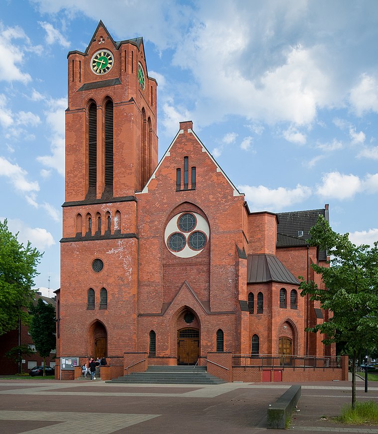
Photo: Tuxyso, CC BY-SA 3.0.
Christuskirche Altendorf is a church, which is situated 720 metres northeast of KGV Essen West e.V. - Nöggerathstraße.
Places in the Area
Nearby places include Bochold and Borbeck-Mitte.
Bochold
Suburb
Bochold is a northwestern borough of the city of Essen, Germany. It was incorporated into the city in 1915. Before it had been part of the Bürgermeisterei Borbeck.
Borbeck-Mitte
Suburb

Photo: Wikimedia, CC BY-SA 3.0.
Borbeck-Mitte is the central borough of Borbeck, the fourth suburban district of Essen, Germany. Together with the other boroughs of the district, it was incorporated on April 1, 1915.
Margarethenhöhe
Suburb

Photo: Wiki05, Public domain.
Margarethenhöhe is a suburb, which is situated 2½ km south of KGV Essen West e.V. - Nöggerathstraße.
KGV Essen West e.V. - Nöggerathstraße
- Type: Allotment garden
- Location: Essen, Düsseldorf, Ruhr, North Rhine-Westphalia, Germany, Central Europe, Europe
- View on OpenStreetMap
Latitude
51.45584° or 51° 27′ 21″ northLongitude
6.96536° or 6° 57′ 55″ eastOpen location code
9F38FX48+84OpenStreetMap ID
way 30106891OpenStreetMap feature
landuse=allotments
This page is based on OpenStreetMap, Wikidata, and Wikimedia Commons.
We’d love your help improving our open data sources. Thank you for contributing.
Satellite Map
Discover KGV Essen West e.V. - Nöggerathstraße from above in high-definition satellite imagery.
Notable Places Nearby
Highlights include Merkez-Moschee and Gedenktafel Kriegsgefangenenlager.
Nearby Places
Explore places such as P&R, Essen-Frohnhausen and Essen-Frohnhausen.
Ruhr: Must-Visit Destinations
Delve into Dortmund, Duisburg, Gelsenkirchen, and Bochum.
Curious Allotment Gardens to Discover
Uncover intriguing allotment gardens from every corner of the globe.
About Mapcarta. Data © OpenStreetMap contributors and available under the Open Database License". Text is available under the CC BY-SA 4.0 license, except for photos, directions, and the map. Photo: Tuxyso, CC BY-SA 3.0.