Abwasserverband Oberes Stremtal
Abwasserverband Oberes Stremtal is a wastewater treatment plant in Bocksdorf, Güssing District, Burgenland which is located on Sportgasse. Abwasserverband Oberes Stremtal is situated nearby to the basin Klärbecken, as well as near the pitch Stockschützen / Eislaufplatz.| Tap on a place to explore it |
Places of Interest Nearby
Highlights include Stegersbach and Pfarrkirche Bocksdorf.
Stegersbach
Town hall

Photo: Isiwal, CC BY-SA 3.0 at.
Stegersbach is a town in the district of Güssing in the Austrian state of Burgenland. Stegersbach is situated 3 km northwest of Abwasserverband Oberes Stremtal.
Pfarrkirche Bocksdorf
Church

Photo: Ueb-at, CC BY-SA 3.0.
Pfarrkirche Bocksdorf is a church, which is situated 1 km northwest of Abwasserverband Oberes Stremtal.
Kath. Filialkirche hl. Johannes von Nepomuk
Church

Photo: Ueb-at, CC BY-SA 3.0.
Kath. Filialkirche hl. Johannes von Nepomuk is a church, which is situated 2½ km southwest of Abwasserverband Oberes Stremtal.
Places in the Area
Nearby places include Rohrbrunn and Burgau.
Rohrbrunn
Village

Photo: Steindy, CC BY-SA 2.0 de.
Rohrbrunn is a village in Burgenland, Austria. It is part of the municipality of Deutsch Kaltenbrunn in the district of Jennersdorf. Rohrbrunn is located near the border of Styria by the river Lafnitz. Rohrbrunn is situated 5 km west of Abwasserverband Oberes Stremtal.
Burgau
Village

Photo: Cerana, CC BY-SA 3.0.
Burgau is a municipality in the district of Hartberg-Fürstenfeld in Styria, Austria. It is in the south-east of the country, near the border with Hungary. Burgau is situated 6 km west of Abwasserverband Oberes Stremtal.
Rehgraben
Village
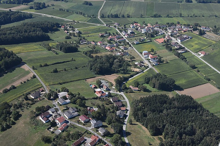
Photo: Iswoar, CC BY-SA 3.0.
Rehgraben is a village, which is situated 8 km southeast of Abwasserverband Oberes Stremtal.
Abwasserverband Oberes Stremtal
- Type: Wastewater treatment plant
- Address: Sportgasse 42, Bocksdorf, 7551
- Category: industry
- Location: Bocksdorf, Güssing District, Burgenland, Austria, Central Europe, Europe
- View on OpenStreetMap
Latitude
47.13823° or 47° 8′ 18″ northLongitude
16.18339° or 16° 11′ 0″ eastOpen location code
8FVR45QM+79OpenStreetMap ID
way 30336191OpenStreetMap feature
man_made=wastewater_plant
This page is based on OpenStreetMap, Wikidata, and Wikimedia Commons.
We’d love your help improving our open data sources. Thank you for contributing.
Satellite Map
Discover Abwasserverband Oberes Stremtal from above in high-definition satellite imagery.
Notable Places Nearby
Highlights include Klärbecken and Stockschützen / Eislaufplatz.
Nearby Places
Explore places such as Bocksdorf Gasthaus Weiss and Bocksdorf Feuerwehr.
Burgenland: Must-Visit Destinations
Delve into Eisenstadt, Neusiedl am See, Rust, and Güssing.
Curious Wastewater Treatment Plants to Discover
Uncover intriguing wastewater treatment plants from every corner of the globe.
About Mapcarta. Data © OpenStreetMap contributors and available under the Open Database License". Text is available under the CC BY-SA 4.0 license, except for photos, directions, and the map. Photo: Wikimedia, CC BY-SA 4.0.