STROHAL / Leykam Let’s Print
STROHAL / Leykam Let’s Print is an industrial building in Müllendorf, Eisenstadt-Umgebung District, Burgenland which is located on Industriestraße I. STROHAL / Leykam Let’s Print is situated nearby to the railway station Müllendorf, as well as near the sports venue Sportplatz.| Tap on a place to explore it |
Places of Interest Nearby
Highlights include Johanneskapelle and Sebastiankreuz Großhöflein.
Johanneskapelle
Church

Photo: Bwag, CC BY-SA 3.0.
Johanneskapelle is a church, which is situated 790 metres northeast of STROHAL / Leykam Let’s Print.
Sebastiankreuz Großhöflein
Wayside shrine

Photo: Bwag, CC BY-SA 3.0.
Sebastiankreuz Großhöflein is a wayside shrine, which is situated 1 km east of STROHAL / Leykam Let’s Print.
Weißes Kreuz
Chapel

Photo: Bwag, CC BY-SA 3.0.
Weißes Kreuz is a chapel, which is situated 1½ km northwest of STROHAL / Leykam Let’s Print.
Places in the Area
Nearby places include Steinbrunn and Kleinhöflein im Burgenland.
Steinbrunn
Village

Photo: Steindy, CC BY-SA 4.0.
Steinbrunn is a town in the district of Eisenstadt-Umgebung in the Austrian state of Burgenland. Steinbrunn is situated 3 km west of STROHAL / Leykam Let’s Print.
Kleinhöflein im Burgenland
Village
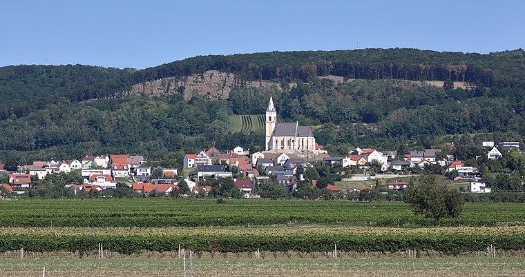
Photo: Bwag, CC BY-SA 4.0.
Kleinhöflein im Burgenland is a village, which is situated 3½ km east of STROHAL / Leykam Let’s Print.
Zillingtal
Village

Photo: Steindy, CC BY-SA 3.0.
Zillingtal is a community of 1,005 inhabitants in the West of the district of Eisenstadt-Umgebung in Austria's federal state Burgenland. There is a minority population of Burgenland Croats. Zillingtal is situated 4 km southwest of STROHAL / Leykam Let’s Print.
STROHAL / Leykam Let’s Print
- Type: Industrial building
- Address: Industriestraße I 3, 7052
- Categories: building and industry
- Location: Müllendorf, Eisenstadt-Umgebung District, Burgenland, Austria, Central Europe, Europe
- View on OpenStreetMap
Latitude
47.83421° or 47° 50′ 3″ northLongitude
16.45345° or 16° 27′ 12″ eastOpen location code
8FVRRFM3+M9OpenStreetMap ID
way 30343855OpenStreetMap feature
building=industrial
This page is based on OpenStreetMap, Wikidata, and Wikimedia Commons.
We’d love your help improving our open data sources. Thank you for contributing.
Satellite Map
Discover STROHAL / Leykam Let’s Print from above in high-definition satellite imagery.
Notable Places Nearby
Highlights include Müllendorf and Bahnhof Müllendorf.
Nearby Places
Explore places such as Wirtshaus Müllendorf and PET to PET Recycling Österreich.
Burgenland: Must-Visit Destinations
Delve into Eisenstadt, Neusiedl am See, Rust, and Güssing.
Curious Industrial Buildings to Discover
Uncover intriguing industrial buildings from every corner of the globe.
About Mapcarta. Data © OpenStreetMap contributors and available under the Open Database License". Text is available under the CC BY-SA 4.0 license, except for photos, directions, and the map. Photo: Wikimedia, CC BY-SA 4.0.