Erddeponie
Erddeponie is a landfill in Salem, Bodenseekreis, Baden-Württemberg. Erddeponie is situated nearby to the archaeological site Hügelgräber Hardtwald, as well as near the church Stefansfeld-Kapelle.| Tap on a place to explore it |
Places of Interest Nearby
Highlights include Salem Abbey and Stefansfeld-Kapelle.
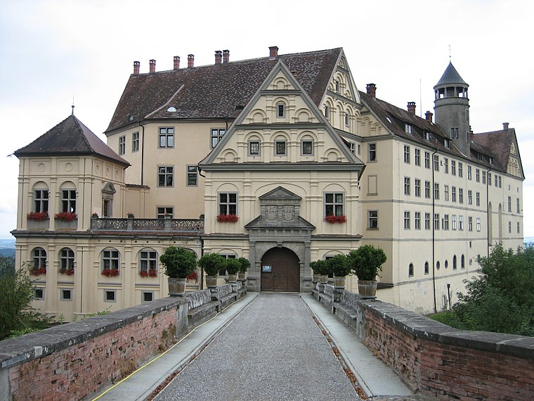
Salem Abbey
Museum

Photo: Carsten Steger, CC BY-SA 4.0.
Salem Abbey was a very prominent Cistercian monastery at Salem in the district of Bodensee, about ten miles from Konstanz in Baden-Württemberg, Germany. Salem Abbey is situated 1½ km west of Erddeponie.
Stefansfeld-Kapelle
Church

Photo: Stefan-Xp, CC BY-SA 3.0.
Stefansfeld-Kapelle is a church, which is situated 1 km west of Erddeponie.
Schwarzer Graben
Nature reserve

Photo: Heinzbeinz, CC BY-SA 4.0.
Schwarzer Graben is a nature reserve.
Places in the Area
Nearby places include Leutkirch and Heiligenberg.

Heiligenberg
Village
 Heiligenberg is a municipality and a village in the Bodensee district in Baden-Württemberg, about seven kilometres north of Salem, in Germany. Heiligenberg is situated 5 km north of Erddeponie.
Lippertsreute
Village

Photo: DKrieger, CC BY-SA 3.0.
Lippertsreute is a village, which is situated 5 km northwest of Erddeponie.
Erddeponie
- Type: Landfill
- Location: Salem, Bodenseekreis, Tübingen Region, Baden-Württemberg, Germany, Central Europe, Europe
- View on OpenStreetMap
Latitude
47.77901° or 47° 46′ 44″ northLongitude
9.29934° or 9° 17′ 58″ eastOpen location code
8FVFQ7HX+JPOpenStreetMap ID
way 30606720OpenStreetMap feature
landuse=landfill
This page is based on OpenStreetMap, Wikidata, and Wikimedia Commons.
We’d love your help improving our open data sources. Thank you for contributing.
Satellite Map
Discover Erddeponie from above in high-definition satellite imagery.
Places with the Same Name
Discover other places named “Erddeponie”.
Notable Places Nearby
Highlights include Hügelgräber Hardtwald and Robinson-Crusoe-Insel.
Nearby Places
Explore places such as Wanderparkplatz and Netto Marken-Discount.
Baden-Württemberg: Must-Visit Destinations
Delve into Stuttgart, Heidelberg, Karlsruhe, and Mannheim.
Curious Landfills to Discover
Uncover intriguing landfills from every corner of the globe.
About Mapcarta. Data © OpenStreetMap contributors and available under the Open Database License". Text is available under the CC BY-SA 4.0 license, except for photos, directions, and the map. Photo: Traveler100, CC BY-SA 3.0.