P7 Brauerei
P7 Brauerei is a parking area in Lich, Giessen, Hesse. Access is restricted and requires permission. P7 Brauerei is situated nearby to Karate Dojo Lich, as well as near the health club Turnfabrik.| Tap on a place to explore it |
- Access is restricted and requires permission.
- Type: Parking area
- Parking: surface
Places of Interest Nearby
Highlights include Lich (Oberhess) station and Schloss Lich.
Lich (Oberhess) station
Railway station
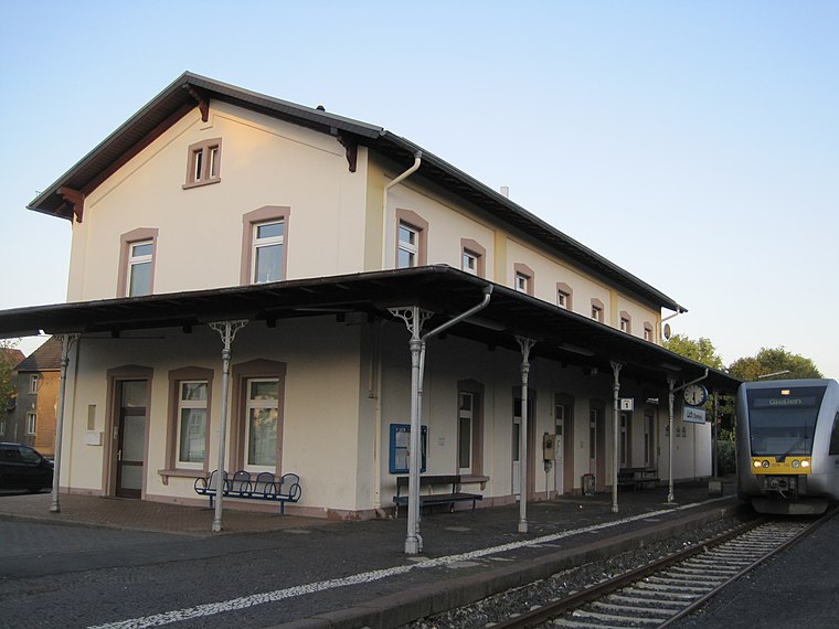
Photo: Stefan Flöper, CC BY-SA 4.0.
Lich (Oberhess) station is a railway station, which is situated 160 metres southeast of P7 Brauerei.
Schloss Lich
Castle
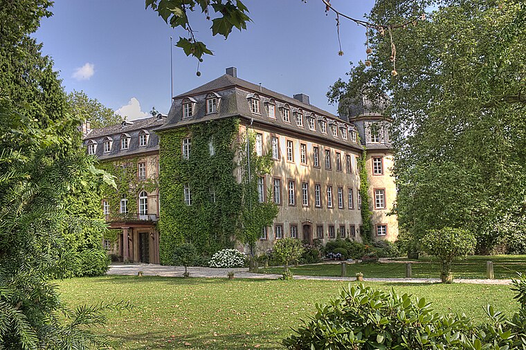
Photo: Steschke, CC BY-SA 3.0 de.
Schloss Lich is a castle, which is situated 320 metres north of P7 Brauerei.
Unterstadt 1
Town hall

Photo: Cherubino, CC BY-SA 3.0.
Unterstadt 1 is a town hall, which is situated 500 metres north of P7 Brauerei.
Places in the Area
Nearby places include Holzheim and Annerod.

Annerod
Village

Photo: Cherubino, CC BY-SA 4.0.
Annerod is a small village, part of the municipality Fernwald, in Germany between Gießen and Großen-Buseck approximately 70 km north of Frankfurt. Annerod has a population of about 3189 people. Annerod is situated 9 km northwest of P7 Brauerei.
P7 Brauerei
- Category: transportation
- Location: Lich, Giessen, North Hesse, Hesse, Germany, Central Europe, Europe
- View on OpenStreetMap
Latitude
50.51553° or 50° 30′ 56″ northLongitude
8.81981° or 8° 49′ 11″ eastOperator
Licher BrauereiOpen location code
9F2CGR89+6WOpenStreetMap ID
way 30678142OpenStreetMap feature
amenity=parkingOpenStreetMap attribute
parking=surface
This page is based on OpenStreetMap, Wikidata, and Wikimedia Commons.
We’d love your help improving our open data sources. Thank you for contributing.
Satellite Map
Discover P7 Brauerei from above in high-definition satellite imagery.
Notable Places Nearby
Highlights include Karate Dojo Lich and Turnfabrik.
Nearby Places
Explore places such as Metzgerei Stein and Logi.
North Hesse: Must-Visit Destinations
Delve into Kassel, Wetzlar, Marburg, and Fulda.
Curious Parking Areas to Discover
Uncover intriguing parking areas from every corner of the globe.
About Mapcarta. Data © OpenStreetMap contributors and available under the Open Database License". Text is available under the CC BY-SA 4.0 license, except for photos, directions, and the map. Photo: Kreuzschnabel, CC BY-SA 3.0.