Merrimack River
Merrimack River is a river in City of Haverhill, Essex, Massachusetts. Merrimack River is situated nearby to the hamlet Ward Hill, as well as near The Valley.| Tap on a place to explore it |
Places of Interest
Highlights include Bradford station and Haverhill station.
Bradford station
Railway station
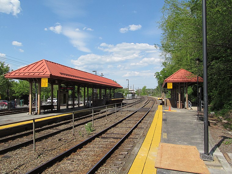
Photo: Faolin42, CC BY-SA 3.0.
Bradford station is an MBTA Commuter Rail station in the Bradford neighborhood of Haverhill, Massachusetts, served by the Haverhill Line. The Haverhill Line's layover yard is located adjacent to the station.
Haverhill station
Railway station
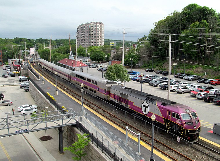
Photo: Pi.1415926535, CC BY-SA 4.0.
Haverhill station is an intercity and regional rail station located in downtown Haverhill, Massachusetts, United States. It is served by Amtrak's Downeaster service and the MBTA Commuter Rail Haverhill/Reading Line; it is the northern terminus of MBTA service on the line.
Northpoint Bible College
College
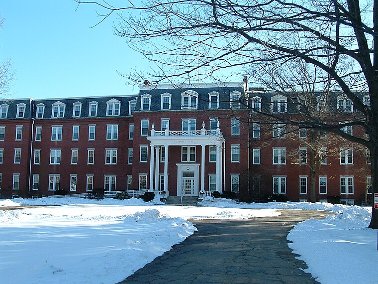
Photo: Chonak, CC BY-SA 3.0.
Northpoint Bible College and Seminary is a private Pentecostal Bible college and seminary in Haverhill, Massachusetts. The college's sole purpose is to teach and train students for Pentecostal ministry for the spread of the Christian gospel.
Places in the Area
Nearby places include Haverhill and Salem.
Haverhill
 Haverhill is a city in Essex County, Massachusetts, United States. Haverhill is located 35 miles north of Boston on the New Hampshire border and about 17 miles from the Atlantic Ocean.
Salem

Photo: Wikimedia, Public domain.
Salem is a town in Rockingham County, New Hampshire, United States. The population was 30,089 at the 2020 census and an estimated 30,647 in 2022. Salem is a suburb of Boston and Manchester located on Interstate 93.
Bradford
Hamlet
Bradford is a village and former town in Essex County, Massachusetts, United States. Eastern Bradford is the current town of Groveland, while western Bradford was annexed by the city of Haverhill, and today consists of the part of Haverhill on the south bank of the Merrimack River.
Merrimack River
- Type: River
- Category: body of water
- Location: City of Haverhill, Essex, Massachusetts, New England, United States, North America
- View on OpenStreetMap
Latitude
42.7644° or 42° 45′ 52″ northLongitude
-71.126° or 71° 7′ 33″ westOpen location code
87JCQV7F+QJOpenStreetMap ID
way 30704769OpenStreetMap feature
natural=waterOpenStreetMap feature
water=river
This page is based on OpenStreetMap, Wikidata, and Wikimedia Commons.
We’d love your help improving our open data sources. Thank you for contributing.
Satellite Map
Discover Merrimack River from above in high-definition satellite imagery.
Places with the Same Name
Discover other places named “Merrimack River”.
Localities in the Area
Explore places such as Ward Hill and The Valley.
Notable Places Nearby
Highlights include Covanta Haverhill Power Plant and Mitchels Falls.
Massachusetts: Must-Visit Destinations
Delve into Boston, Cambridge, Springfield, and Downtown Boston.
Curious Rivers to Discover
Uncover intriguing rivers from every corner of the globe.
About Mapcarta. Data © OpenStreetMap contributors and available under the Open Database License". Text is available under the CC BY-SA 4.0 license, except for photos, directions, and the map. Photo: papadunes, CC BY-SA 3.0.