M
M is an office building in Fürth, Middle Franconia, Bavaria. M is situated nearby to the health club FitX, as well as near the sports venue Rollsporthalle Eckart.| Tap on a place to explore it |
Places of Interest Nearby
Highlights include Fürth-Klinikum station and Fürth Hardhöhe station.
Fürth-Klinikum station
Railway station

Photo: Janericloebe, CC BY 3.0.
Fürth-Klinikum station is a railway station in the city of Fürth, located in Bavaria, Germany. The station is on the Nuremberg–Bamberg line of Deutsche Bahn. Fürth-Klinikum station is situated 410 metres northeast of M.
Fürth Hardhöhe station
Metro station
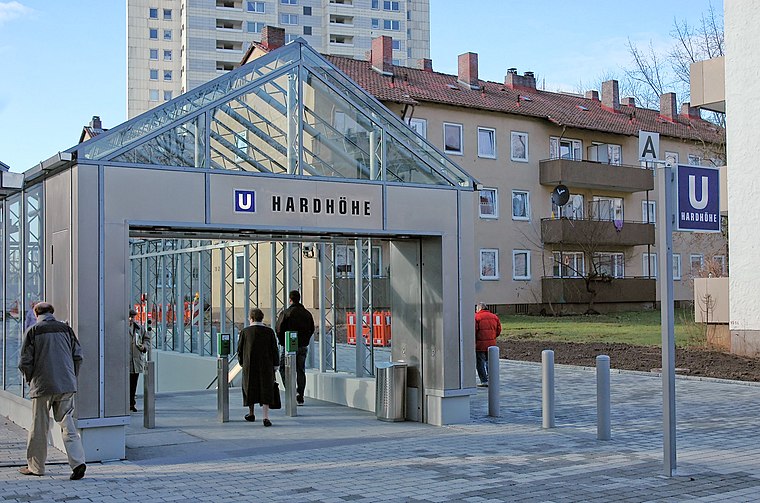
Photo: Wikimedia, CC BY-SA 3.0.
Fürth Hardhöhe station is a Nuremberg U-Bahn station located on line U1 in Fürth, and was opened on 8 December 2007. This station is the western terminus of line U1. Fürth Hardhöhe station is situated 390 metres west of M.
Christkönig
Church

Photo: Janericloebe, CC BY 3.0.
Christkönig is a church, which is situated 480 metres east of M.
Places in the Area
Nearby places include Unterfürberg and Unterfarrnbach.


M
- Type: Office building
- Categories: building and office
- Location: Fürth, Middle Franconia, Franconia, Bavaria, Germany, Central Europe, Europe
- View on OpenStreetMap
Latitude
49.48079° or 49° 28′ 51″ northLongitude
10.96286° or 10° 57′ 46″ eastLevels
4Open location code
8FXGFXJ7+84OpenStreetMap ID
way 30771896OpenStreetMap feature
building=office
This page is based on OpenStreetMap, Wikidata, and Wikimedia Commons.
We’d love your help improving our open data sources. Thank you for contributing.
Satellite Map
Discover M from above in high-definition satellite imagery.
Notable Places Nearby
Highlights include FitX and Skate Coach.
Nearby Places
Explore places such as Siemens and Primetals.
Middle Franconia: Must-Visit Destinations
Delve into Nuremberg, Erlangen, Ansbach, and Rothenburg ob der Tauber.
Curious Office Buildings to Discover
Uncover intriguing office buildings from every corner of the globe.
About Mapcarta. Data © OpenStreetMap contributors and available under the Open Database License". Text is available under the CC BY-SA 4.0 license, except for photos, directions, and the map. Photo: Wikimedia, CC BY-SA 3.0.