Sporthalle im Kronried
Sporthalle im Kronried is a sports venue in Bad Saulgau, Sigmaringen, Baden-Württemberg which is located on Schützenstraße. Sporthalle im Kronried is situated nearby to the sports venue Hallenbad Bad Saulgau, as well as near the government office Finanzamt Sigmaringen - Außenstelle Bad Saulgau.| Tap on a place to explore it |
Places of Interest Nearby
Highlights include Saulgau airfield and Kino Saulgau.

Kino Saulgau
Movie theater
 Kino Saulgau is a movie theater, which is situated 1 km southwest of Sporthalle im Kronried.
Bad Saulgau station
Railway station
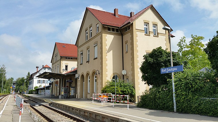
Photo: Hohenzollernsche Lande, CC BY-SA 4.0.
Bad Saulgau station is a railway station in the municipality of Bad Saulgau, located in the Sigmaringen district in Baden-Württemberg, Germany. Bad Saulgau station is situated 1 km southwest of Sporthalle im Kronried.
Places in the Area
Nearby places include Bad Saulgau and Siessen Monastery.
Bad Saulgau
Town

Photo: DKrieger, CC BY-SA 3.0.
Bad Saulgau is a town in the district of Sigmaringen, in Baden-Württemberg, Germany. It is situated 23 km east of Sigmaringen, and 27 km north of Ravensburg between the Danube and Lake Constance.
Siessen Monastery
Neighborhood

Photo: Flodur63, CC BY-SA 4.0.
Siessen Monastery is a neighborhood, which is situated 3½ km southwest of Sporthalle im Kronried.
Schwarzenbach
Hamlet

Photo: Flodur63, CC BY-SA 4.0.
Schwarzenbach is a hamlet, which is situated 5 km south of Sporthalle im Kronried.
Sporthalle im Kronried
- Type: Sports venue
- Address: Schützenstraße 63, Bad Saulgau, 88348
- Categories: building, recreation area, and sports location
- Location: Bad Saulgau, Sigmaringen, Tübingen Region, Baden-Württemberg, Germany, Central Europe, Europe
- View on OpenStreetMap
Latitude
48.02173° or 48° 1′ 18″ northLongitude
9.50767° or 9° 30′ 28″ eastOpen location code
8FWF2GC5+M3OpenStreetMap ID
way 315156633OpenStreetMap feature
building=yesOpenStreetMap feature
leisure=sports_centreOpenStreetMap feature
sport=multi
This page is based on OpenStreetMap, Wikidata, and Wikimedia Commons.
We’d love your help improving our open data sources. Thank you for contributing.
Satellite Map
Discover Sporthalle im Kronried from above in high-definition satellite imagery.
Notable Places Nearby
Highlights include Hallenbad Bad Saulgau and Finanzamt Sigmaringen - Außenstelle Bad Saulgau.
Nearby Places
Explore places such as Windkraftanlage SFZ and Walter Knoll Schulverbund.
Baden-Württemberg: Must-Visit Destinations
Delve into Stuttgart, Heidelberg, Karlsruhe, and Mannheim.
Curious Sports Venues to Discover
Uncover intriguing sports venues from every corner of the globe.
About Mapcarta. Data © OpenStreetMap contributors and available under the Open Database License". Text is available under the CC BY-SA 4.0 license, except for photos, directions, and the map. Photo: Traveler100, CC BY-SA 3.0.