Pesquera d’en Lero - Oficina de turisme de Banyoles
Pesquera d’en Lero - Oficina de turisme de Banyoles is a tourism office in Banyoles, Girona, Catalonia. Pesquera d’en Lero - Oficina de turisme de Banyoles is situated nearby to the scenic viewpoint Mirador Joan de Palau, as well as near the museum Mobles Terrades.| Tap on a place to explore it |
Places of Interest Nearby
Highlights include Museo Darder and Estanyol de la Cendra.
Museo Darder
Museum

Photo: Wikimedia, CC BY-SA 3.0.
Museo Darder is a museum, which is situated 730 metres east of Pesquera d’en Lero - Oficina de turisme de Banyoles.
Estanyol de la Cendra
Lagoon
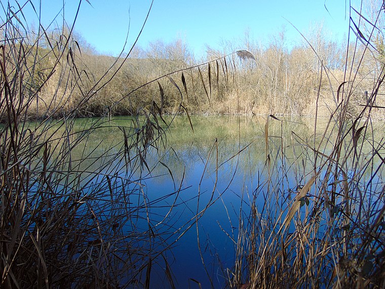
Photo: Jvinolase, CC BY-SA 4.0.
Estanyol de la Cendra is a lagoon, which is situated 710 metres southwest of Pesquera d’en Lero - Oficina de turisme de Banyoles.
Church of Santa Maria de Porqueres
Church

Photo: Enfo, CC BY-SA 3.0.
Church of Santa Maria de Porqueres is situated 770 metres northwest of Pesquera d’en Lero - Oficina de turisme de Banyoles.
Places in the Area
Nearby places include Porqueres and Mata.

Mata
Village

Photo: Jvinolase, CC BY-SA 4.0.
Mata is a village, which is situated 2½ km southeast of Pesquera d’en Lero - Oficina de turisme de Banyoles.
Puigpalter de Dalt
Hamlet

Photo: Jvinolase, CC BY-SA 4.0.
Puigpalter de Dalt is a hamlet, which is situated 3 km east of Pesquera d’en Lero - Oficina de turisme de Banyoles.
Pesquera d’en Lero - Oficina de turisme de Banyoles
- Type: Tourism office
- Categories: information, building, and tourism
- Location: Banyoles, Girona, Catalonia, Eastern Spain, Spain, Iberia, Europe
- View on OpenStreetMap
Latitude
42.11788° or 42° 7′ 4″ northLongitude
2.75631° or 2° 45′ 23″ eastOpen location code
8FJ44Q94+5GOpenStreetMap ID
way 315924973OpenStreetMap feature
building=yesOpenStreetMap feature
tourism=information
This page is based on OpenStreetMap, Wikidata, and Wikimedia Commons.
We’d love your help improving our open data sources. Thank you for contributing.
Satellite Map
Discover Pesquera d’en Lero - Oficina de turisme de Banyoles from above in high-definition satellite imagery.
Notable Places Nearby
Highlights include Mirador Joan de Palau and Mobles Terrades.
Nearby Places
Explore places such as Pesquera Butinyà and The City Arms.
Girona: Must-Visit Destinations
Delve into Girona, Figueres, Llivia, and Lloret de Mar.
Curious Tourism Offices to Discover
Uncover intriguing tourism offices from every corner of the globe.
About Mapcarta. Data © OpenStreetMap contributors and available under the Open Database License". Text is available under the CC BY-SA 4.0 license, except for photos, directions, and the map. Photo: Wikimedia, CC0.