Freiwillige Feuerwehr Heiningen
Freiwillige Feuerwehr Heiningen is a fire station in Heiningen, Göppingen, Baden-Württemberg which is located on Mörikestraße. Freiwillige Feuerwehr Heiningen is situated nearby to the town hall Rathaus Heiningen, as well as near the church Michaelskirche.| Tap on a place to explore it |
Places of Interest Nearby
Highlights include Göppingen-Bezgenriet airfield and Jüdisches Museum Göppingen.
Göppingen-Bezgenriet airfield
Aerodrome
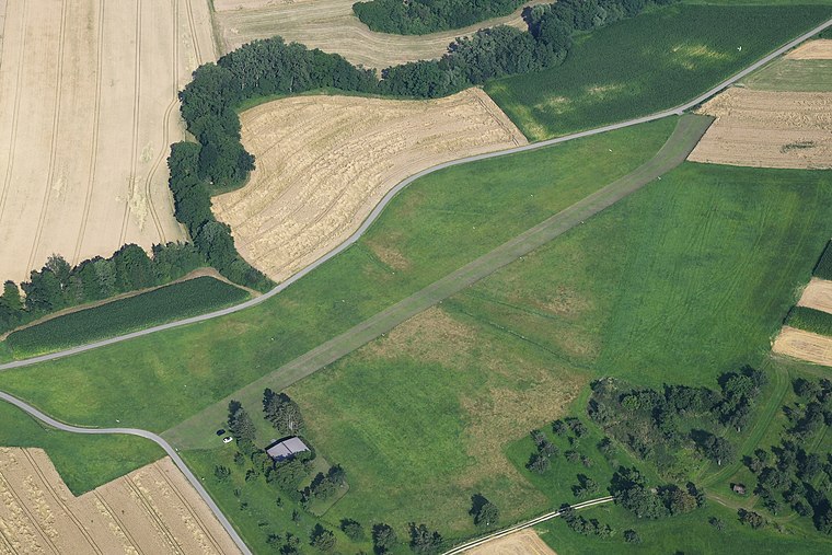
Photo: Carsten Steger, CC BY-SA 4.0.
Göppingen-Bezgenriet airfield is an aerodrome.
Jüdisches Museum Göppingen
Museum

Photo: Don-kun, CC BY-SA 4.0.
Jüdisches Museum Göppingen is situated 2½ km northwest of Freiwillige Feuerwehr Heiningen.
Schloss Liebenstein
Castle
 Schloss Liebenstein is a castle, which is situated 2½ km northwest of Freiwillige Feuerwehr Heiningen.
Places in the Area
Nearby places include Bezgenriet and Jebenhausen.
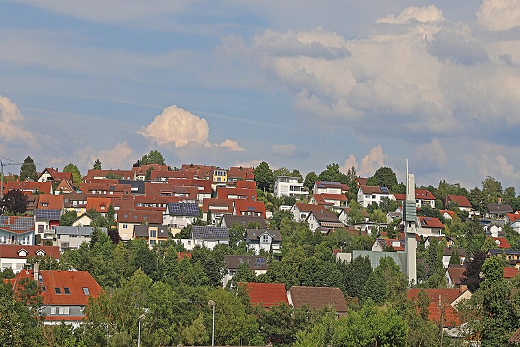
Bezgenriet
Village
Bezgenriet is the most southern district of Göppingen in Germany. Schopflenberg, which was created after Second World War by increased influx of refugees and displaced persons, belongs to the Stadtteil Bezgenriet.
Pliensbach
Hamlet
Pliensbach is a hamlet in the municipality of Zell unter Aichelberg in the district of Göppingen in central Baden-Württemberg. Pliensbach is situated 4½ km west of Freiwillige Feuerwehr Heiningen.
Freiwillige Feuerwehr Heiningen
- Type: Fire station
- Address: Mörikestraße 57, Heiningen, 73092
- Category: building
- Location: Heiningen, Göppingen, Stuttgart, Baden-Württemberg, Germany, Central Europe, Europe
- View on OpenStreetMap
Latitude
48.66411° or 48° 39′ 51″ northLongitude
9.64208° or 9° 38′ 32″ eastOpen location code
8FWFMJ7R+JROpenStreetMap ID
way 320398950OpenStreetMap feature
amenity=fire_stationOpenStreetMap feature
building=yes
This page is based on OpenStreetMap, Wikidata, and Wikimedia Commons.
We’d love your help improving our open data sources. Thank you for contributing.
Satellite Map
Discover Freiwillige Feuerwehr Heiningen from above in high-definition satellite imagery.
Places with the Same Name
Discover other places named “Freiwillige Feuerwehr Heiningen”.
Notable Places Nearby
Highlights include Rathaus Heiningen and Michaelskirche.
Nearby Places
Explore places such as Breitekindergarten and DRK OV Heiningen-Eschenbach.
Baden-Württemberg: Must-Visit Destinations
Delve into Stuttgart, Heidelberg, Karlsruhe, and Mannheim.
Curious Fire Stations to Discover
Uncover intriguing fire stations from every corner of the globe.
About Mapcarta. Data © OpenStreetMap contributors and available under the Open Database License". Text is available under the CC BY-SA 4.0 license, except for photos, directions, and the map. Photo: Traveler100, CC BY-SA 3.0.