Terrain du Justemont
Terrain du Justemont is a pitch in Grand Est, France. Terrain du Justemont is situated nearby to the church Chapelle Sainte-Anne de Fameck, as well as near the village Budange.| Tap on a place to explore it |
Places of Interest Nearby
Highlights include Chapelle Sainte-Anne de Fameck and Ancienne église Saint-Hubert de Gandrange.
Chapelle Sainte-Anne de Fameck
Church
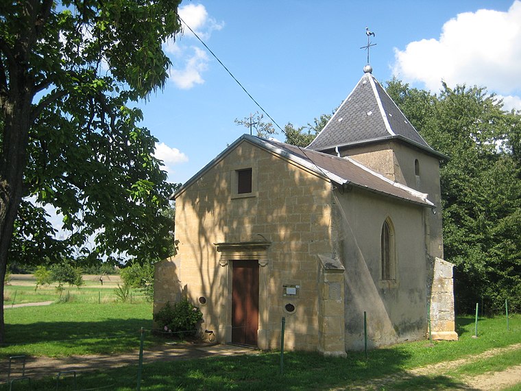
Photo: Aimelaime, Public domain.
Chapelle Sainte-Anne de Fameck is a church, which is situated 560 metres north of Terrain du Justemont.
Ancienne église Saint-Hubert de Gandrange
Library

Photo: Aimelaime, Public domain.
Ancienne église Saint-Hubert de Gandrange is a library, which is situated 1½ km south of Terrain du Justemont.
Nouvelle église Saint-Pierre de Boussange
Church

Photo: Aimelaime, Public domain.
Nouvelle église Saint-Pierre de Boussange is a church, which is situated 2 km southeast of Terrain du Justemont.
Places in the Area
Nearby places include Budange and Vitry-sur-Orne.
Vitry-sur-Orne
Village
Vitry-sur-Orne is a commune in the Moselle department in Grand Est in north-eastern France. It is part of the urban area of Metz.
Fameck
Town

Photo: Aimelaime, Public domain.
Fameck is a commune in the Moselle department in Grand Est in north-eastern France. Localities of the commune: Budange and in German: Büdingen unter Justberg, Edange, Morlange, Rémelange. Fameck is situated 3 km northwest of Terrain du Justemont.
Terrain du Justemont
- Type: Pitch
- Categories: recreation area, football, and sports location
- Location: Grand Est, France, Europe
- View on OpenStreetMap
Latitude
49.28258° or 49° 16′ 57″ northLongitude
6.12311° or 6° 7′ 23″ eastOpen location code
8FX874MF+26OpenStreetMap ID
way 32643224OpenStreetMap feature
leisure=pitchOpenStreetMap feature
sport=soccer
This page is based on OpenStreetMap, Wikidata, and Wikimedia Commons.
We’d love your help improving our open data sources. Thank you for contributing.
Satellite Map
Discover Terrain du Justemont from above in high-definition satellite imagery.
Notable Places Nearby
Highlights include Les Faubourgs de l’Orne and Temple.
Nearby Places
Explore places such as Parking du Parcours de Santé and Les Amis du Médicis.
Grand Est: Must-Visit Destinations
Delve into Strasbourg, Reims, Metz, and Nancy.
Curious Pitches to Discover
Uncover intriguing pitches from every corner of the globe.
About Mapcarta. Data © OpenStreetMap contributors and available under the Open Database License". Text is available under the CC BY-SA 4.0 license, except for photos, directions, and the map. Photo: Florival fr, CC BY-SA 3.0.